


Press release
New Research Platform Brings Modern Statistical Methods to the Study of Ptolemy's Germania Magna
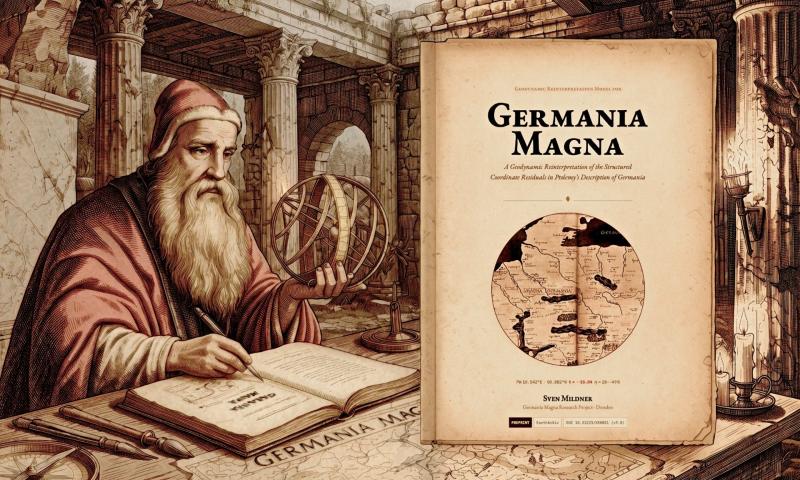
Ptolemy working on his calculations for the Geographike Hyphegesis (free artistic depiction)
The study, authored by independent researcher Sven Mildner based in Dresden, Germany, focuses on Germania Magna, the Roman designation for the vast territories north of the Danube and east of the Rhine - a region Ptolemy described in considerable detail, yet one whose coordinate data has long puzzled historians and geographers due to significant and spatially structured discrepancies with modern geography.
Where earlier scholarship has typically attributed these discrepancies to accumulated measurement error or medieval transcription mistakes, the platform introduces an alternative methodological framework: a kinematic block-deformation model that treats coordinate offsets not as random noise, but as potentially structured signals amenable to quantitative analysis. Using GIS-based affine transformations and residual analysis, the model identifies a coherent group of Ptolemaic place-names in the Elster-Lusatia region whose displacements are statistically inconsistent with uniform measurement error - and proposes a physically motivated correction based on structural-geological kinematics.
A defining characteristic of the approach is its resistance to the standard objection levelled at cartometric modelling: that unconstrained digital distortion can produce arbitrary fits. The kinematic framework operates under seven simultaneously active, independent constraints - among them a fixed geometric scaling factor derived from the Rhine-Elbe baseline, hydrographic topological requirements that uniquely identify specific river systems, and a geochemical anchor at a structurally anomalous site in Lusatia. With fewer degrees of freedom than there are constraints, the system is formally overdetermined, meaning its parameters cannot be tuned freely to absorb residuals. This is put to the test in a formal out-of-sample blind test: a stratified 70/30 train-test split yields residual improvements of 29-49% on held-out data points never seen during model fitting. One result stands out in particular - the position of the eastern terminus of the Sudete Mons block, estimated from a single training point, is recovered to within 7.5 km: an improvement of 89.7% over the uncorrected baseline.
The research does not stop at the initial observation. Articles on ancientmaps-geography.com document the progressive stress-testing of the hypothesis across multiple independent validation layers: a full statistical battery including AIC/BIC model comparison, leave-one-out cross-validation, bootstrap resampling, permutation testing, and Moran's I spatial autocorrelation. A subsequent identification-multiverse analysis examined whether the statistical result depends on which modern locations are matched to which Ptolemaic place-names - exhaustively sampling a space of more than 55 billion possible identification combinations, across all of which the core displacement signal remains statistically significant.
Beyond the cartometric core, the platform explores early-modern maps as palaeogeographic archives. A dedicated analysis of Mercator's 16th-century Europae Tabula IIII suggests that some cartographic features traditionally dismissed as draughting conventions may in fact preserve geometrically verifiable traces of ancient drainage systems no longer present in the modern landscape. One such case is the map's depiction of the ancient Vistula's western course, which the platform argues may encode knowledge of the Senftenberger Elbelauf - a Miocene-to-Early-Quaternary palaeodrainage system running northward through the Lusatia region, documented in active gravel-mining exposures. This gives rise to a broader methodological paradigm the platform terms palaeodrainage cartometry, one it argues may be transferable to other historically active regions such as Asia Minor and the Levant.
AncientMaps - Geography is conceived as an ongoing research programme. Each successive version of the model introduces new evidence, refines existing identifications, and extends the statistical validation suite. A formal falsification programme defines more than forty individually decisive tests - geological, geochemical, geochronological, and cartometric - each capable of disconfirming specific components of the hypothesis independently of the others. Readers wishing to engage with the technical details directly can also make use of an AI research assistant embedded in the platform, capable of answering subject-specific questions about the model's methods, data, and findings.
The research is presented in full on ancientmaps-geography.com, with the underlying scientific manuscript freely available as a preprint on EarthArXiv (doi.org/10.31223/X5KB51) and all data and statistical outputs openly archived on Zenodo. The platform explicitly invites scrutiny from researchers in historical cartography, structural geology, and palaeoenvironmental research.
Further details and the full series of articles are available at:
https://www.ancientmaps-geography.com
Germania Magna Research Project
Sven Mildner
Briesnitzer Höhe 28
01157 Dresden
Germany
https://www.ancientmaps-geography.com
AncientMaps-Geography.com is an independent research platform dedicated to the quantitative study of ancient cartography and historical geography. Combining digital cartometry, GIS-based residual analysis, and modern statistical methods with perspectives from structural geology, palaeoenvironmental research, and the history of science, it aims to provide transparent, evidence-based analyses of ancient geographic sources - with a particular focus on Claudius Ptolemy's Geographike Hyphegesis and the cartographic tradition of early-modern Europe.
This release was published on openPR.
Permanent link to this press release:
Copy
Please set a link in the press area of your homepage to this press release on openPR. openPR disclaims liability for any content contained in this release.
You can edit or delete your press release New Research Platform Brings Modern Statistical Methods to the Study of Ptolemy's Germania Magna here
News-ID: 4593340 • Views: …
More Releases for Ptolemy
Time Is Finally Decoded: In the Quest for the Unification of Classical and Quant …
The concept of time has eluded scientists for hundreds of years. Isaac Newton said that one second on Earth is one second on Jupiter.
Unlike Isaac Newton, Einstein said that time is a river that speeds up and slows down. He came up with a theory, special relativity, in which he combined time and space into space-time as a fourth dimension in the universe. Scientists started looking at time in a…
Time Is Finally Decoded - In the Quest for Unification of Classical and Quantum …
The concept of time has eluded scientists for hundreds of years. Sir Isaac Newton said that one second on Earth is one second on Jupiter.
Unlike Isaac Newton, Einstein said that time is a river that speeds up and slows down. He came up with a theory, special relativity, in which he combined time and space into space-time as a fourth dimension in the universe. Scientists started looking at time in…
Old World Auctions' Auction #195, Ending Nov. 15, Features Antique and Vintage M …
Richmond, VA, USA, November 2, 2023 -- The landmark Fry-Jefferson map of Virginia and Maryland from 1775; the first printed sea chart of the Southeastern coastline of North America from 1661; the French edition of John Mitchell's monumental map of eastern North America from 1756; and the first printed map to name the colony of Georgia are just a few of the rare antique items in Old World Auctions' Auction…
Unraveling the Mystery of Biorhythm Cycles and Pseudoscience (Impacts on Human B …
Independent researcher Chiharu Matsushima has revealed the long-standing mysteries of biorhythm cycles and the pseudoscience surrounding them, which gained worldwide popularity as a trend in the 1960s to 1980s, particularly in Japan and the United States. Matsushima's research suggests that the physical, emotional, and intellectual states of human beings may be influenced by the revolution of planets.
Biorhythm cycles and heliocentric astrology, based on the revolution of planets, show striking similarities…
Rare Antique Maps and A Carved, Painted Carousel Giraffe are in Neue Auctions' M …
Beachwood, OH, USA, March 3, 2023 -- Neue Auctions' 342-lot, online-only Neue to You - Estate Fine Art and Antiques auction on Saturday, March 11th, starting at 12 o'clock noon Eastern time, is filled with fine art, antiques, Mid-Century Modern, Modern Art, sterling, bronzes, decorative arts, printwork, maps, fine furniture, carpets and more, from prominent estates and collections.
The sale's expected top lot is an unusual but rare and visually striking…
The Secret Of Ophiuchus : 13th Zodiac Sign
The constellation “Ophiuchus” is not new to our astronomers, and its existence is as old as our knowledge of solar system. Professor kunkle of Minneapole’s University has created a furor in the astrological world by citing alleged astronomical principles which necessitates the creation of thirteenth sign. Let us examine the statement of Prof. Kunkle which necessitated the creation 13th sign.
1. The zodiac is an arbitrary epileptic ring on which all the…

