


Press release
Schneider Digital - Stereoscopic Display Technologies for Military Applications
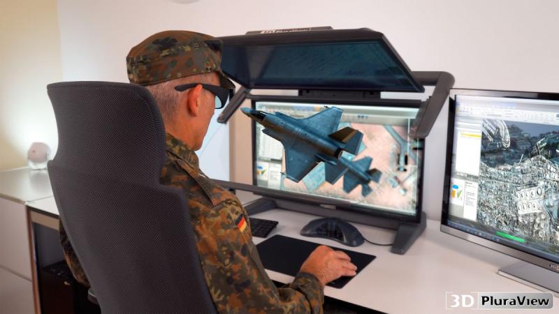
3D PluraView by Schneider Digital: NATO-standard-compliant stereoscopic displays. ( (C) Schneider Digital GmbH)
3D Stereo for GEOINT, Simulation, and Situational Awareness
Military forces around the world use digital, stereoscopic displays in a variety of applications. A particular focus is on GEOINT applications--that is, the collection, analysis, and interpretation of georeferenced information. In addition, there are immersive virtual simulation environments, training scenarios, and large-format visualization solutions for situation briefings and operations centers.
Among the most important COTS software solutions in the GEOINT field are SOCET GXP from BAE Systems, Collins SCi-X, and ArcGIS Pro from Esri. The range of applications is complemented by numerous GIS, remote sensing, mapping, and photogrammetry solutions from other manufacturers such as Hexagon, Trimble, Bentley, and other providers.
Even with commercially available hardware and software, it is now possible to provide flexible, high-performance, and comparatively cost-effective resources for GEOINT specialists. Stereoscopic visualization is particularly useful for tasks in which spatial depth, elevation data, object recognition, and precise interpretation of geodata are critical.
Wide Range of Applications for Military 3D Visualization
Digital 3D stereo technology is suitable for numerous military and security-related applications. These include the stereoscopic analysis of high-resolution and multispectral satellite imagery, tactical reconnaissance using airborne EO reconnaissance sensor systems, and the analysis and integration of imagery, LiDAR, radar, and other sensor data.
Realistic 3D city models, textured building models, and complex mesh environments are also becoming increasingly important for simulation, mission preparation, and virtual training scenarios. They can be used for VR and AR systems, head-mounted displays, mission planning, or the training of emergency responders. Other areas of application include visibility and route feasibility analyses, location simulation for surveillance systems, the planning of temporary infrastructure, and the stereoscopic display of video data, such as that from drones or remotely piloted systems.
The GEOINT field has always been closely linked to stereoscopic visualization. As early as the early 20th century, aerial photographs were viewed stereoscopically to better interpret terrain features, structures, and target information. Today, digital 3D stereo systems perform this task with significantly greater precision, a wider variety of data, and direct integration into professional GIS, mapping, photogrammetry, and remote sensing workflows.
3D meshes, point clouds, and hybrid geodata
The power of modern IT infrastructures now enables the processing of very large 3D mesh and point cloud datasets with high accuracy and depth of detail. Specialized modeling software such as SURE from nFrames or Skyline Terra Software can be used in combination with game engines like Unity or Unreal Engine to quickly render realistic 3D scenarios and output them stereoscopically.
This allows complex situational and simulation scenarios to be depicted realistically. Vehicles, ships, aircraft, or other object models can be integrated into virtual environments to make operational relationships spatially understandable. At the same time, browser and streaming technologies such as Cesium or comparable platforms open up new possibilities for efficiently delivering large geodata sets over secure networks and visualizing them in a decentralized manner.
The transition from local, isolated VR solutions to scalable client-server architectures provides additional flexibility. Stereo-capable thin-client workstations can help make complex 3D geospatial data accessible even at distributed locations--for example, for analysis, planning, training, or joint situation briefings.
Different Stereo Technologies for Different Requirements
Various stereoscopic visualization technologies are available for military applications. They differ primarily in terms of user group, interactivity, resolution, ergonomics, and the ability to integrate into existing software environments.
Head-mounted displays are frequently used for personal, immersive applications. They are particularly well-suited for virtual environments, training applications, and individual simulations. Augmented reality glasses and helmets can overlay 3D information directly onto the real environment, thereby making situation-specific information available. Autostereoscopic displays enable glasses-free 3D viewing; however, depending on the system, they are limited by reduced resolution, fixed viewing positions, or restricted interaction capabilities. Active LCD shutter systems were widely used for many years but are increasingly considered technologically obsolete in many professional applications.
For professional workplaces and small groups, passive 3D stereo systems such as the 3D PluraView offer clear advantages. With up to 4K resolution per screen, passively polarized stereo glasses, high brightness, and flicker-free display, they are particularly well-suited for prolonged work with complex geodata. GEOINT analysts can use them to precisely capture, measure, interpret, and interact with 3D datasets. At the same time, the solution remains usable for smaller groups, such as in meeting or analysis settings.
For larger groups, control rooms, and immersive simulation environments, large-format stereoscopic VR walls or CAVE systems are suitable options. They are particularly well-suited for presentations, shared situational awareness, and virtual training scenarios involving multiple viewers.
Schneider Digital: From Stereo Workstations to Powerwalls
For military and security-critical applications, Schneider Digital's display systems offer high resolution, high brightness, ergonomic operation, and great flexibility when used in conjunction with professional software applications. Both the passive 3D PluraView monitors and the active smartVR and smart3D Wall systems require no proprietary graphics drivers and can be operated with professional NVIDIA and AMD graphics cards.
When combined with high-performance Schneider Digital workstations, these systems create scalable, turnkey solutions for a variety of applications: from compact 3D stereo workstations for GEOINT analysts to networked analysis environments and large-format stereoscopic data presentation in simulation and situation centers. Upon request, these systems can be certified according to the NATO SDIP-27 standard for security-critical environments.
In this way, Schneider Digital combines precise 3D stereo visualization, professional workstation performance, and many years of experience in demanding high-end hardware environments. The result is practical visualization solutions for the acquisition, analysis, and presentation of complex military geodata.
Further information.
LEAD Industrie-Marketing GmbH
Hauptstr. 46
Tegernsee 83684
Germany
https://www.lead-industrie-marketing.de
Herr Andr? Gessner
+49 (0) 8022 91 53 188
+49 (0) 8022 91 53 189
info@lead-industrie-marketing.de
Schneider Digital - The Company:
Schneider Digital is a global, full-service solution provider for professional 3D stereo, 4K/8K, and VR/AR hardware. Drawing on 30 years of industry and product experience, as well as its excellent relationships with leading manufacturers, Schneider Digital offers innovative, sophisticated professional hardware products and customized turnkey solutions for professional use. Qualified consulting and dedicated after-sales service are the company's own standards.
The Schneider Digital product portfolio includes the right professional hardware solution for every requirement in these areas: from high-resolution 4K/8K to multi-display walls. Schneider Digital manufactures its own Powerwall solution, the Laser smartVR-Wall, as well as the passive stereo monitor 3D PluraView. High-performance workstations and professional graphics cards from AMD and NVIDIA, as well as innovative hardware peripherals (tracking, input devices, and much more), round out the product lineup. Many items are in stock, ensuring fast delivery and project implementation.
Schneider Digital is an authorized service distributor for AMD FirePRO/Radeon Pro, PNY/NVIDIA Quadro, 3Dconnexion, Stealth int., Planar, and EIZO. Schneider Digital products are primarily used in graphics-intensive computer applications such as CAD/CAM/CAE, FEM, CFD, simulation, GIS, architecture, medicine and research, film, TV, animation, digital imaging, and AI.
For more information, visit www.schneider-digital.com and www.PluraView.com.
This release was published on openPR.
Permanent link to this press release:
Copy
Please set a link in the press area of your homepage to this press release on openPR. openPR disclaims liability for any content contained in this release.
You can edit or delete your press release Schneider Digital - Stereoscopic Display Technologies for Military Applications here
News-ID: 4572484 • Views: …
More Releases from Schneider Digital
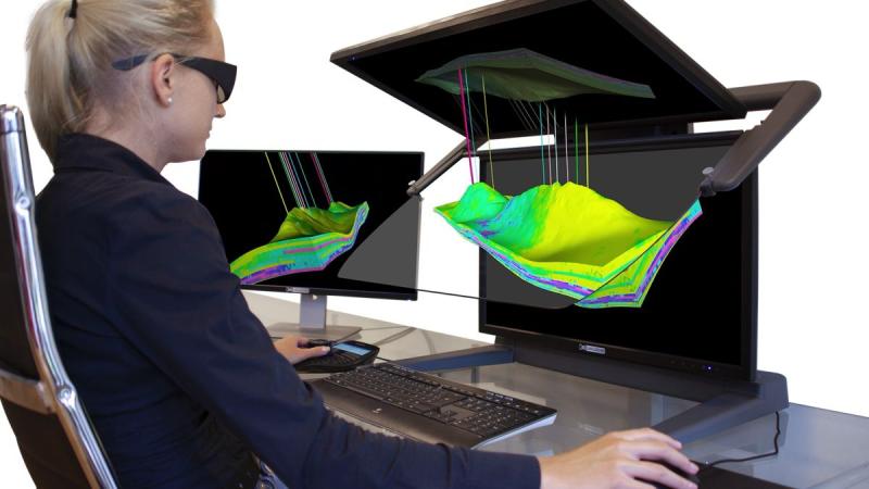
Schneider Digital's 3D PluraView makes complex oil and gas geodata spatially acc …
To optimize the exploration and production of oil and gas fields and increase yield and efficiency, complex geological conditions must be precisely understood. A better spatial understanding helps identify problems earlier, minimize avoidable delays, and reduce costs. For geologists and geophysicists, the visualization of 3D geodata is key to the informed analysis and evaluation of geological and geophysical information components. Schneider Digital's stereoscopic 3D PluraView dual-screen systems with integrated beam…
Global Market Overview of Stereoscopic Software Solutions: Vendor-Neutral & Hard …
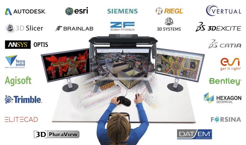
Holzkirchen, March 22, 2026 - Many users in high-tech industries such as biochemistry and molecular research, geoinformation (GIS, photogrammetry, and LiDAR), medicine (CT, MRI, and ultrasound), or engineering (CAD, CAM, and 3D printing) are often unaware of which applications available on the market support stereoscopy. Unlike monoscopic, flat-perspective displays, these applications enable true, spatial 3D visualization.
After approximately two years of intensive research, Schneider Digital--a company known for professional 4K/8K and…
Technology Partnership Between Schneider Digital and Tebis for Maximum Performan …
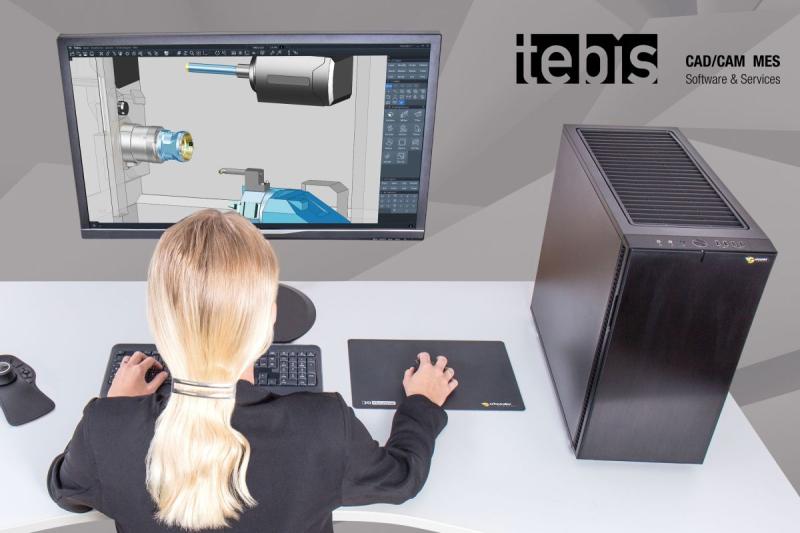
Holzkirchen, March 25, 2026 - Tebis AG, a leading provider of CAD/CAM software solutions, and Schneider Digital, a renowned manufacturer of professional high-performance workstations, have entered into a strategic technology partnership. The goal is to develop Tebis-certified workstation solutions that are perfectly tailored to the requirements of Tebis software--for maximum performance, efficiency, and reliability in all phases of the CAD/CAM process.
Perfect alignment for maximum productivity
This close cooperation results in a…
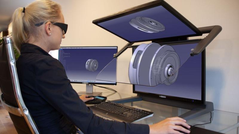
CATIA certified for PluraView 3D monitor
Developed by Dassault Syst?mes, CATIA has been one of the world's leading platforms for design and virtual product development for decades. What once began in aircraft construction can now be found in almost all high-tech sectors--such as the automotive industry, mechanical and plant engineering, construction, energy and product technology, and the medical field. Development teams in more than 140 countries rely on the software to digitally realize ideas, reliably evaluate…
More Releases for PluraView
Schneider Digital's 3D PluraView makes complex oil and gas geodata spatially acc …
To optimize the exploration and production of oil and gas fields and increase yield and efficiency, complex geological conditions must be precisely understood. A better spatial understanding helps identify problems earlier, minimize avoidable delays, and reduce costs. For geologists and geophysicists, the visualization of 3D geodata is key to the informed analysis and evaluation of geological and geophysical information components. Schneider Digital's stereoscopic 3D PluraView dual-screen systems with integrated beam…
CATIA certified for PluraView 3D monitor
Developed by Dassault Syst?mes, CATIA has been one of the world's leading platforms for design and virtual product development for decades. What once began in aircraft construction can now be found in almost all high-tech sectors--such as the automotive industry, mechanical and plant engineering, construction, energy and product technology, and the medical field. Development teams in more than 140 countries rely on the software to digitally realize ideas, reliably evaluate…
3D PluraView Monitor - certified by Esri ArcGIS Pro for 3D stereo visualization
ArcGIS Pro is currently the most modern and advanced desktop GIS product from Esri and is used worldwide to capture, process and analyze high-resolution 3D data. Essential functions from photogrammetry - such as the import of aerial images, their triangulation, the creation of a terrain model, orthorectification and stereoscopic data acquisition - are now also included in ArcGIS Pro. With the continuous further development of ArcGIS Pro, the boundaries between…
3D PluraView optimizes Hexagon ImageStation® photogrammetry workflow
With the sophisticated and flexible ImageStation® photogrammetry environment from the Swedish measurement technology and software company HEXAGON, particularly large volumes of aerial image, UAS and satellite data can be efficiently processed, managed and used for geodata acquisition. A central task that is solved extremely efficiently with ImageStation® is the precise, interactive capture of 3D objects and infrastructure - such as buildings, roads, bridges and natural terrain features.
In Germany, topographic surveying…
3D PluraView - Stereoscopic 3D visualization for the oil and gas industry
With up to 4K resolution per stereo channel and screen, the user benefits from a consistently available, extremely bright and high-contrast 3D stereo display when evaluating stratigraphic profiles, seismic 3D data, borehole information and 3D models derived from it. In the oil and gas industry, stereo-capable software, such as Petrel from Schlumberger, Halliburton GeoProbe or MapInfo Discover, is used specifically for exploration and increasing production. These allow professional users to…
CATIA is certified for 3D PluraView
The 3D software application CATIA from the French company Dassault Systemes has already successfully established itself in many sectors worldwide: in the aerospace, automotive and supplier industries, the construction sector, industrial manufacturing, energy and product technology, mechanical and plant engineering, healthcare and Formula 1. CATIA is not just a CAD application, but a comprehensive software package for product design and product development. With CATIA, users can model any product and…

