


Press release
Schneider Digital's 3D PluraView makes complex oil and gas geodata spatially accessible
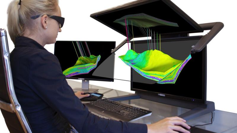
Optimal visualization of 3D geodata in the oil and gas industry with the 3D PluraView. ( (C) Schneider Digital GmbH)
Petroleum engineers and geoscientists invest a great deal of time combining 2D and 3D datasets from multiple sources to generate digital 3D subsurface models. This data is available in various formats, resolutions, and very large volumes. The stereoscopic monitors of the 3D PluraView series, with their proven beam splitter technology, offer high-quality display at the workstation and serve as the central visualization interface for the creation and analysis of digital 3D twins. Schneider Digital's 3D monitors can display captured surface and subsurface structures as well as dynamic processes relevant to exploration and production. At the same time, true stereoscopic visualization facilitates collaboration within exploration and production teams: multiple specialists can view, analyze, and discuss a dataset simultaneously. This is made possible by a bright, holographic-looking geodata display in a normal, non-darkened office environment and with a flexible viewing angle of nearly 180 degrees.
Optimal visualization for stereoscopic 3D geodata in the workplace
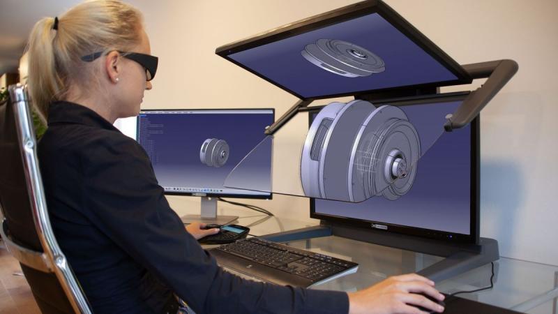
The 3D PluraView monitors are ideally suited for stereoscopically displaying 3D deposit models together with detailed surface data. Two high-resolution screens generate the stereo images for the left and right eyes. Via the beam splitter--a specially coated half-silvered mirror--both images are combined into a very bright and high-contrast holographic stereo image. Due to the different polarization angles of the PluraView glasses, both stereo channels remain clearly separated. This results in a precise 3D stereo display for the professional desktop.
Stereoscopic visualization is an essential component of professional geology software, including Schlumberger Petrel, Halliburton GeoProbe, Baker Hughes JewelSuite, Dassault GEOVIA modules, and MapInfo Discover. 3D stereo is also relevant in the GIS field: With ArcGIS Pro, Esri has implemented a stereoscopic 3D GIS environment that can, among other things, map stratigraphic and tectonic structures in the subsurface using 3D voxel elements.
The visualization and, in particular, the editing of spatial structures in 3D stereo environments is a key function. With a stereo-capable display, spatial relationships can be understood immediately and intuitively, as well as captured with precision. Compared to simple screens, which offer only a flat, perspective-based 2D view without true depth perception, 3D stereo supports a significantly more reliable understanding of complex subsurface data.
Modern software environments for exploration and production are three-dimensional and volume-based. Due to high costs and risks, they must be efficient, reliable, and optimized for data processing. Subsequent field operations must comply with HSE standards; thus, the entire process chain must demonstrably adhere to state-of-the-art technology and best practices. Schneider Digital's 3D PluraView monitors provide a field-proven hardware foundation for this purpose: They are high-resolution 3D stereo desktop systems designed for fatigue-free daily use in standard office environments and are particularly suitable for:
o 3D geodata visualization of stratigraphy and tectonic surfaces
o Interpretation of 3D seismic data
o Integration of 3D surface and subsurface data
o Reserve evaluation and analysis
o Field development planning
o 3D modeling of property rights
o Preparation and visualization of directional drilling
o Reservoir simulation and pressure drop modeling
o Industrial plant simulation and installation of production technology
o Dynamic modeling using the finite element method (FEM)
o Oil and gas 3D pressure applications
o Software training for geologists, geophysicists, and petroleum engineers
o Geoscience education
Reliably validating exploration results with 3D models
A comprehensive understanding of the available geological and geophysical 3D data is required to evaluate the stratigraphic and tectonic structures as well as the rock properties of oil and gas reservoirs in terms of their production potential. To this end, 3D seismic profiles are acquired, among other methods, to identify reflection horizons, structures, and faults. Combined with data from existing well logs, aeromagnetic surveys, and geoelectric surveys, this creates the most robust possible 3D model of the reservoir. If the evaluation is positive, this model can be expanded with additional geodata sets to make informed decisions regarding the number, positioning, direction, and depth of further exploration wells or initial production wells.
The representation of deposits in true 3D also supports comprehensive static and dynamic models, extending to 4D time-lapse simulations. This allows pressure reductions and flow changes to be clearly simulated under various production scenarios. The combination, evaluation, and interpretation of various 3D features are crucial for a high-quality digital representation of the reservoir. These include major tectonic structures such as sealing or non-sealing faults, the modeling of stratigraphic layers, and information on source, reservoir, and cap rock layers. This data is supplemented by reflection horizons from geophysical exploration, physical rock material from drill cuttings and core samples, and petrophysical parameters from geophysical wellbore surveys.
A good subsurface model depicts the spatial relationships and properties of relevant features in sufficient detail. This allows the future behavior of an oil and gas reservoir to be estimated with reasonable accuracy under various production scenarios. Schneider Digital's stereoscopic visualization technology makes these spatial relationships comprehensible and helps oil and gas engineers evaluate potential reservoirs, estimate reserves, predict reservoir properties and production behavior, and further optimize production planning.
Particularly at the intersection of exploration, production technology, and plant engineering, environmental protection, regulatory requirements, and official approval procedures are critical decision-making factors alongside economic considerations. Geodata prepared at the workstation on the 3D PluraView and visualized stereoscopically can also be displayed stereoscopically on large-format projection systems and LED walls. This makes complex relationships easier to understand for larger groups of viewers, such as internal decision-makers or government representatives. The 3D PluraView monitors are thus a key tool for geologists, geophysicists, and engineers to create, visualize, analyze, and gain a more reliable understanding of complex 3D subsurface datasets.
Benefits of 3D Stereo Visualization Technology for Oil and Gas Companies
o 3D PluraView monitors are compatible with nearly any workstation; depending on software requirements, they can also be used with laptop hardware and standard professional graphics cards.
o No special drivers, IT configurations, or stereo signal generators--such as those required for active LCD shutter glasses--are needed. The systems work with standard NVIDIA or AMD graphics drivers and are designed for current versions of Windows and Linux.
o The display is flicker-free and enables comfortable, long-term work with lightweight, passive, cross-polarized stereo glasses.
o Small workgroups of two to six users can view datasets stereoscopically together, particularly with the 27-inch and 28-inch 3D PluraView models.
o Bright, high-contrast displays with up to 4K resolution per stereo channel allow for use in standard office and daylight environments.
o True spatial depth perception supports intuitive and faster understanding of stratigraphic and tectonic features.
o 3D stereo visualization supports leading stereo-capable applications for geoscientists and engineers.
o Spatial representation improves the validation of work results, reduces misinterpretations, and supports robust decision-making.
LEAD Industrie-Marketing GmbH
Hauptstr. 46
Tegernsee 83684
Germany
https://www.lead-industrie-marketing.de
Herr Andr? Gessner
+49 (8022) - 91 53 188
+49 (8022) - 91 53 189
info@lead-industrie-marketing.de
Schneider Digital - The Company:
Schneider Digital is a global full-service solution provider for professional 3D stereo, 4K/8K, and VR/AR hardware. Drawing on 25 years of industry and product experience, as well as its excellent relationships with leading manufacturers, Schneider Digital offers innovative, sophisticated professional hardware products and customized turnkey solutions for professional use. Qualified consulting and dedicated after-sales service are the company's own standards.
The Schneider Digital product portfolio includes the right professional hardware solution for every requirement in these areas: from high-resolution 4K/8K to multi-display walls. Schneider Digital manufactures its own Powerwall solution, the Laser smartVR-Wall, as well as the passive stereo monitor 3D PluraView. Performance workstations and professional graphics cards from AMD and NVIDIA, along with innovative hardware peripherals (tracking, input devices, and much more), round out the offering. Many items are in stock, ensuring fast delivery and project implementation.
Schneider Digital is an authorized service distributor for AMD FirePRO/Radeon Pro, PNY/NVIDIA Quadro, 3Dconnexion, Stealth int., Planar, and EIZO. Schneider Digital products are primarily used in graphics-intensive computer applications such as CAD/CAM/CAE, FEM, CFD, simulation, GIS, architecture, medicine and research, film, TV, animation, digital imaging, and AI.
For more information, visit www.schneider-digital.com and www.PluraView.com.
This release was published on openPR.
Permanent link to this press release:
Copy
Please set a link in the press area of your homepage to this press release on openPR. openPR disclaims liability for any content contained in this release.
You can edit or delete your press release Schneider Digital's 3D PluraView makes complex oil and gas geodata spatially accessible here
News-ID: 4522113 • Views: …
More Releases from Schneider Digital
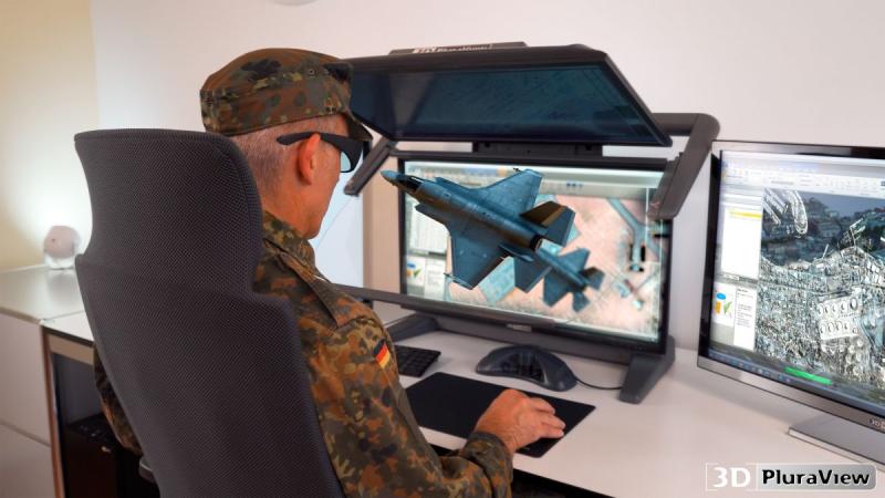
Schneider Digital - Stereoscopic Display Technologies for Military Applications
Digital 3D stereo visualization has long since become a key technology in military applications. Given the changing security landscape in Europe, there is a growing need for high-performance, interoperable, and secure IT workstations for reconnaissance, situational awareness analysis, and simulation-based mission planning. Particularly in the field of geospatial intelligence (GEOINT), 3D stereo visualization enables the spatially precise analysis of complex image, terrain, and sensor data. Schneider Digital offers professional stereoscopic…
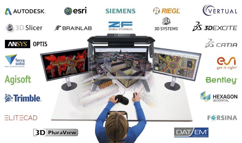
Global Market Overview of Stereoscopic Software Solutions: Vendor-Neutral & Hard …
Holzkirchen, March 22, 2026 - Many users in high-tech industries such as biochemistry and molecular research, geoinformation (GIS, photogrammetry, and LiDAR), medicine (CT, MRI, and ultrasound), or engineering (CAD, CAM, and 3D printing) are often unaware of which applications available on the market support stereoscopy. Unlike monoscopic, flat-perspective displays, these applications enable true, spatial 3D visualization.
After approximately two years of intensive research, Schneider Digital--a company known for professional 4K/8K and…
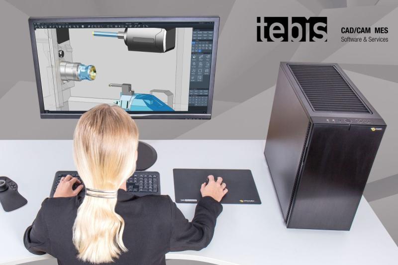
Technology Partnership Between Schneider Digital and Tebis for Maximum Performan …
Holzkirchen, March 25, 2026 - Tebis AG, a leading provider of CAD/CAM software solutions, and Schneider Digital, a renowned manufacturer of professional high-performance workstations, have entered into a strategic technology partnership. The goal is to develop Tebis-certified workstation solutions that are perfectly tailored to the requirements of Tebis software--for maximum performance, efficiency, and reliability in all phases of the CAD/CAM process.
Perfect alignment for maximum productivity
This close cooperation results in a…
CATIA certified for PluraView 3D monitor
Developed by Dassault Syst?mes, CATIA has been one of the world's leading platforms for design and virtual product development for decades. What once began in aircraft construction can now be found in almost all high-tech sectors--such as the automotive industry, mechanical and plant engineering, construction, energy and product technology, and the medical field. Development teams in more than 140 countries rely on the software to digitally realize ideas, reliably evaluate…
More Releases for PluraView
CATIA certified for PluraView 3D monitor
Developed by Dassault Syst?mes, CATIA has been one of the world's leading platforms for design and virtual product development for decades. What once began in aircraft construction can now be found in almost all high-tech sectors--such as the automotive industry, mechanical and plant engineering, construction, energy and product technology, and the medical field. Development teams in more than 140 countries rely on the software to digitally realize ideas, reliably evaluate…
3D PluraView Monitor - certified by Esri ArcGIS Pro for 3D stereo visualization
ArcGIS Pro is currently the most modern and advanced desktop GIS product from Esri and is used worldwide to capture, process and analyze high-resolution 3D data. Essential functions from photogrammetry - such as the import of aerial images, their triangulation, the creation of a terrain model, orthorectification and stereoscopic data acquisition - are now also included in ArcGIS Pro. With the continuous further development of ArcGIS Pro, the boundaries between…
3D PluraView optimizes Hexagon ImageStation® photogrammetry workflow
With the sophisticated and flexible ImageStation® photogrammetry environment from the Swedish measurement technology and software company HEXAGON, particularly large volumes of aerial image, UAS and satellite data can be efficiently processed, managed and used for geodata acquisition. A central task that is solved extremely efficiently with ImageStation® is the precise, interactive capture of 3D objects and infrastructure - such as buildings, roads, bridges and natural terrain features.
In Germany, topographic surveying…
3D PluraView - Stereoscopic 3D visualization for the oil and gas industry
With up to 4K resolution per stereo channel and screen, the user benefits from a consistently available, extremely bright and high-contrast 3D stereo display when evaluating stratigraphic profiles, seismic 3D data, borehole information and 3D models derived from it. In the oil and gas industry, stereo-capable software, such as Petrel from Schlumberger, Halliburton GeoProbe or MapInfo Discover, is used specifically for exploration and increasing production. These allow professional users to…
CATIA is certified for 3D PluraView
The 3D software application CATIA from the French company Dassault Systemes has already successfully established itself in many sectors worldwide: in the aerospace, automotive and supplier industries, the construction sector, industrial manufacturing, energy and product technology, mechanical and plant engineering, healthcare and Formula 1. CATIA is not just a CAD application, but a comprehensive software package for product design and product development. With CATIA, users can model any product and…
3D PluraView Monitor - Esri ArcGIS Pro certified for 3D stereo visualization
ArcGIS Pro is currently the most modern and advanced desktop GIS product from Esri and is used worldwide for the acquisition, processing and analysis of high-resolution 3D data. Important functionality from photogrammetry, such as the import of aerial images, their triangulation, extraction of a terrain model, orthorectification and stereoscopic data acquisition, are now also integrated into ArcGIS Pro. With the continuous further development of ArcGIS Pro, the boundaries between geographic…

