Press release
From GPS tracking to AI-controlled fleet optimization: The evolution of telematics

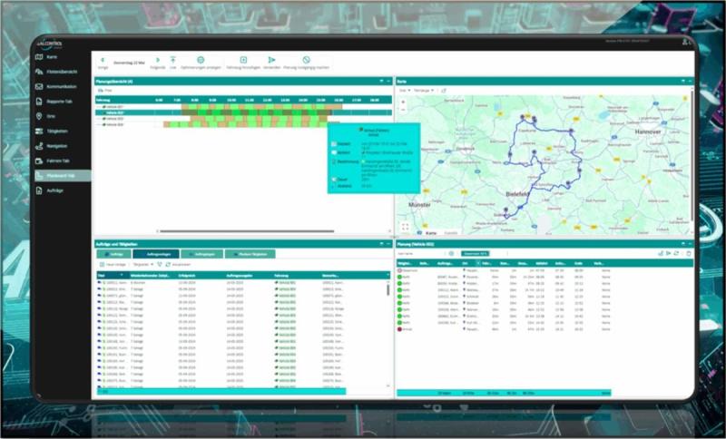
Digital PlanBoard with AI route optimization. Detailed overviews with kilometers, times, stops (© AREALCONTROL GmbH)
The basics: GPS and OBD
The liberalization of GPS technology in the USA in 2000 marked the beginning of a new era in vehicle tracking and monitoring. The combination of GPS with global navigation satellite systems such as GLONASS, BEIDOU and GALILEO (GNSS) made precise positioning possible worldwide. At the same time, the on-board diagnostics (OBD) standard became established, which has been mandatory in many vehicles since the early 2000s and provides a wide range of vehicle data.
First optimization steps with GPS data
The first GPS data sets already opened up a wide range of possibilities for optimizing fleet processes:
* Vehicle location and tracking: By continuously recording location data, it was possible to precisely determine driving times, idle times and distances traveled. Example: Electronic logbook.
* Driving style analysis: The analysis of speed data, acceleration and braking maneuvers enabled an objective assessment of driving style and served as a basis for training measures.
* Dynamic dispatching: The ability to locate vehicles in real time enabled flexible and efficient deployment planning.
* Data analysis and optimization: By evaluating the collected data, weak points in the processes could be identified and optimization potential uncovered.
The addition of OBD/CAN data and other interfaces
The integration of OBD data (on-board diagnostics) into telematics systems enabled an even more detailed analysis of vehicle condition and operation. Over 70 parameters, such as engine temperature, fuel level or inspection requirements, were now available. In combination with machine learning algorithms, this data can be used to plan predictive maintenance and extend the vehicle's service life.
Artificial intelligence for a new dimension of fleet optimization
The use of artificial intelligence has taken telematics to a new dimension. By automating routine tasks and optimizing complex planning processes, it has been possible to achieve significant increases in efficiency.
* Intelligent deployment planning: AI-based algorithms enable the creation of optimal deployment plans for large fleets within the shortest possible time, even under constantly changing conditions.
* Dynamic route planning: Automated adaptation of route plans to changing factors such as traffic volume or order situation ensures maximum efficiency.
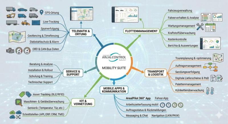
* Integration into existing systems: The seamless integration of telematics systems into ERP, CRM, TMS and BMS systems as well as IoT platforms enables a holistic view of business processes and comprehensive automation.
Conclusion
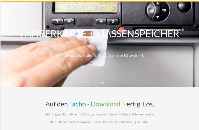
The evolution from simple GPS tracking to AI-driven fleet optimization shows how telematics has fundamentally changed the way companies manage their fleets. The continuous development of the technology and the use of innovative algorithms will open up even more optimization potential in the future. In thousands of companies in the trades, retail, distribution, transport, logistics and technical field service sectors, as well as construction and agriculture, telematics is an elementary tool for fulfilling operational tasks. Often even due to legal requirements, depending on the country. In Poland, for example, GPS tracking has been mandatory for transports for a few years now and is currently mandatory in Romania. The new digital tachographs ("EU control device") also use GPS tracking to automatically document border crossings within the EU (European Union) in the future.
KfdM - Kommunikation für den Mittelstand
Schulstr. 29
84183 Niederviehbach
Germany
https://www.logpr.de
Herr Marcus Walter
0170-7736705
walter@kfdm.eu
AREALCONTROL GmbH, founded in 2003, is a provider of telematics & IoT solutions with optional GPS tracking and tracing as well as software for transport/logistics, trade, craft and construction companies and medium-sized industry. Today, the company offers multiple award-winning solutions for fleet and vehicle fleet requirements in many applications and industries. Most recently, AREALCONTROL won 1st place in the German Telematics Award 2024 and previously in 2022, category "Field Service", 1st place for service cars in 2018 and several 2nd and 3rd places in 2018 - 2020 in truck categories.
This release was published on openPR.
Permanent link to this press release:
Copy
Please set a link in the press area of your homepage to this press release on openPR. openPR disclaims liability for any content contained in this release.
You can edit or delete your press release From GPS tracking to AI-controlled fleet optimization: The evolution of telematics here
News-ID: 3749076 • Views: …
More Releases from AREALCONTROL GmbH

End Isolated Solutions: AREALCONTROL's One-Partner Mobility Suite for Logistics …
Stuttgart, February 11, 2026 - In many companies with fleets - whether in service, transport, logistics, or distribution - the digital reality is characterized by isolated solutions. Telematics systems, driver apps, route planning, IoT sensors, and evaluations often come from different providers. This results in high integration costs, complex coordination, multiple support centers, and nerve-wracking project management. AREALCONTROL GmbH is taking a consistently different approach with its Mobility Suite. Instead…

Digital tachograph 2026: New EU requirements for delivery vans and light trucks
Stuttgart, January 20, 2026 - From July 1, 2026, far-reaching changes to EU social regulations will come into force that will fundamentally change the light commercial vehicle (LCV) sector. AREALCONTROL GmbH, a specialist in telematics and fleet management solutions, provides information about the new digital tachograph requirements and already offers the right technological solutions for affected companies.
The end of the 3.5-ton limit Until now, the strict EU regulations on driving…

Digital platform: Automated tachograph evaluation and expense accounting
Stuttgart, November 17, 2025 - AREALCONTROL GmbH, specialist for telematics and fleet management solutions, presents a comprehensive expansion of its digital platform. In addition to legally compliant tachograph evaluation, companies now also have access to a fully integrated digital expense report.
With this innovation, AREALCONTROL is setting new standards in the automation of administrative processes in the transport and logistics sector. The aim is to relieve specialists of time-consuming routine activities…

AREALCONTROL presents digital innovations at NUFAM 2025
Telematics, AI and automation for fleet, service and logistics
Stuttgart/Karlsruhe, 16 September 2025 - Stuttgart-based AREALCONTROL GmbH will be presenting new solutions for the digital transformation of fleets and service organizations at this year's NUFAM in Karlsruhe (25-28 September). The company has specialized in telematics, fleet management and mobile applications for many years. The brand "All You Can Fleet �" shows the claim. With its innovations, AREALCONTROL combines practical digitalization with…
More Releases for GPS
Furthrive GPS Review: The Best GPS Collar of 2025
Losing a pet can be heartbreaking, and traditional fences do not always keep curious dogs or cats safe during walks, hikes or backyard play. Furthrive GPS changes that with a smart collar system that tracks location in real time and sets invisible boundaries to prevent escapes. This review breaks down how the device works, what pet owners gain from it, and whether it lives up to the promise of simple,…
GPS Market Potential Surge Evaluating GPS Market Growth Opportunities Ahead - 20 …
In recent years, the global GPS Market has witnessed a dynamic shift, influenced by changing consumer preferences, technological advancements, and a growing emphasis on sustainability. The Research report on GPS Market presents a complete judgment of the market through strategic insights on future trends, growth factors, supplier landscape, demand landscape, Y-o-Y growth rate, CAGR, pricing analysis. It also provides and a lot of business matrices including Porters Five Forces Analysis,…
AirBolt GPS Tracker Reviews USA: Is AirBolt GPS Tracker The World's Smartest GPS …
AirBolt GPS Tracker Reviews USA: Is AirBolt GPS Tracker The World's Smartest GPS Tracker? All You Need To Know About AirBolt GPS Tracker Before You Buy.
Looking for a game-changer in the realm of GPS trackers? Enter the AirBolt GPS, a revolutionary device that transcends the limitations of traditional Bluetooth trackers and bulky GPS units. Boasting four years of dedicated refinement, AirBolt presents a masterpiece of technology that redefines tracking…
Global GPS Equipment Market | Global GPS Equipment Industry | Global GPS Equipme …
GPS or Global Positioning System equipment is used to find the real-time location-based accurate information of any vehicle, or other types of assets. GPS detects the person or vehicle that uses the GPS to track its exact location. The location information is stored & transmitted to others, which are connected by the internet using radio, cellular, or satellite modem embedded in the unit. It comprises a GPS module for receiving…
Global GPS Equipment Market | Global GPS Equipment Industry | GPS Equipment Mark …
Global Positioning System or GPS equipment market comprises of sales of global positioning systems equipment & related services to determine the ground position of an object through GPS satellites. It is a satellite navigation system that transmits accurate signals that allow GPS equipment to decode or measure the desired location of the satellite. These equipments are smaller in size. With the advent of technologies, it has been possible to develop…
Global GPS Fleet Tracking System Market 2020 Industry Analysis by Manufacturers …
The market research report entitled Global GPS Fleet Tracking System Market 2020 by Company, Type and Application, Forecast to 2025 provides analysis on market conditions, trends, capability, key players, opportunities, and geographical analysis. The report proves to be an ultimate solution when it comes to a better understanding of the industry and leads the business growth. The report covers an overview of the segments and sub-segmentations including the product types,…