Press release
INTERGEO 2011 – Round Table: Galileo indispensable to pioneering application areas

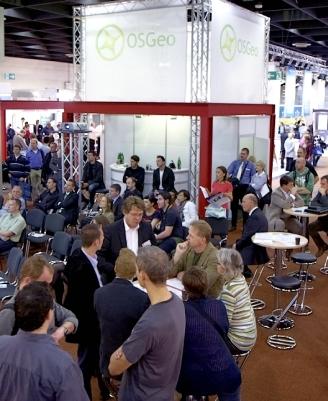
INTERGEO Round Table 2011
Satellite navigation and geoinformation “are two areas that are increasingly converging. It is becoming ever clearer that interdisciplinary cooperation is crucial to enabling the development of new applications,” said Reinfried. As the BMVBS official responsible for the Germany-wide network in the Forum for Satellite Navigation, he anticipates valuable synergies from the Navigation Conference being staged by the BMVBS and BITKOM e.V. on the occasion of INTERGEO 2011. For the first time, the conference is being held in parallel with INTERGEO in Nuremberg from 27 to 29 September 2011.
“The sooner Galileo comes, the earlier we can tap into an even broader range of applications,” believes Ulrich Hermanski. The TOPCON executive listed areas such as agriculture, forestry and infrastructure as examples. Frank Zimmermann from cesah – the expertise, information and startup centre for satellite navigation in the Hesse region of Germany – works with highly innovative, young companies. “Our entrepreneurs come from specific sectors, they understand the problems in these areas and they want to offer a solution,” he explains, underlining his view that GNSS (Global Navigation Satellite System) presents a “cross-sectoral technology”.
“There are not many technologies that are as universally applicable,” adds Hermanski. Jäger also believes that GNSS presents an ideal basis when researching next-generation navigation systems: “Seamless navigation from the outside in.” The professor indirectly alluded to the performance of future smartphones, which Jäger suggested could be used as possible terminals.
Host Hagen Graeff, Chief Representative of DVW GmbH, summed up the Round Table's conclusions: “The result is always a coordinate. By answering the all-important question of 'where?', GNSS gives us the opportunity to make anything possible.” The participants agreed that if the entire spectrum of application fields is to be fully utilised, there will need to be more communication and cooperation, not least between satellite navigation and geoinformation.
The debate will be continued at INTERGEO 2011 in Nuremberg. Olaf Freier, CEO of HINTE GmbH, invited the participants to share knowledge and demands from politics, research and business with a broad international audience at the event.
DVW e.V. – the German Society for Geodesy, Geoinformation and Land Management – is the patron of INTERGEO, which is being held from 27 to 29 September 2011 in Nuremberg.
HINTE GmbH company profile
In a history spanning roughly sixty years, HINTE GmbH has organised more than 600 exhibitions, trade fairs and conferences in all Germany's major exhibition venues. The company is now developing future markets in South-Eastern Europe, organising fairs in cities such as Belgrade and Istanbul. With a portfolio that includes leading B2C and B2B events, some of them international, location is not an issue for the trade fair specialist.
The subsidiary HINTE Marketing & Media GmbH offers comprehensive marketing and PR services in addition to trade fair communication.
HINTE Event-Services GmbH ensures the independent organisation of events in their entirety.
Since the end of 2009, fair network GmbH has been working with German and Swiss trade fair specialists to develop innovative ideas in the B2C sector.
Key figures:
Project year: 2009/2010
Trade fairs: 9
National: 8
Exhibitors: 2,700
Visitors: 230,000
HINTE GmbH
Bannwaldallee 60
76185 Karlsruhe
Germany
+49 (0)721 931 33-0
+49 (0)721 931 33-110
info@hinte-messe.de
www.hinte-messe.de
Press contact:
HINTE GmbH
Ursula Rubenbauer
Tel.: +49 (0)721/931 33-730
E-mail: urubenbauer@hinte-messe.de
www.intergeo.de
This release was published on openPR.
Permanent link to this press release:
Copy
Please set a link in the press area of your homepage to this press release on openPR. openPR disclaims liability for any content contained in this release.
You can edit or delete your press release INTERGEO 2011 – Round Table: Galileo indispensable to pioneering application areas here
News-ID: 178982 • Views: …
More Releases from HINTE GmbH
INTERGEO 2011 - Conference opens with new format for the open data community
Karlsruhe, 4 May 2011. The number of members currently stands at 389,302. And it's not just the number of mappers that is increasing. The importance of the global OpenStreetMap (OSM) community is also rising steadily. The OSM project is therefore enjoying heightened interest at INTERGEO, which will be held in Nuremberg from 27 to 29 September 2011, and is the topic of the first ever INTERGEO BarCamp. The broad-based and…
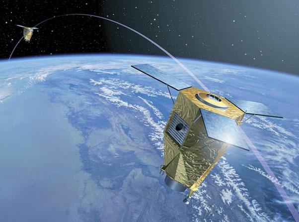
Natural disaster in Japan emphasises need for international networking among geo …
In future, new satellites will support international disaster relief with faster and optimised image data
Karlsruhe, 29 March 2011. When the Earth shook with a magnitude of 9.0 off the coast of Japan on Friday, 11 March, Olaf Kranz and his team at the German Aerospace Centre (DLR) in Oberpfaffenhofen had to react quickly. “In close cooperation with the International Charter 'Space and Major Disasters' and the Japan Aerospace Exploration…

INTERGEO 2011: Geo is the key
Karlsruhe, 28 February 2011. Last year's INTERGEO sent out clear growth signals and encouraged exhibitors and visitors alike to look forward to the next event from 27 – 29 September 2011 in Nuremberg. INTERGEO 2011 will showcase trends and developments that emerged last year. “From 3D developments to satellite applications, the number of increasingly complex systems and solutions is growing all the time, the range of offerings is becoming broader…

Detailed final report INTERGEO 2010
Clear growth signals from the trade fair: “Business is better than was predicted a year ago”
Karlsruhe/Cologne, 10 November 2010. Dr. Hartmut Rosengarten gave a concise summary of the three days of INTERGEO in Cologne: Whereas the focus in 2009 was on “Geo is in”, the talk among industry representatives this year was of “Geo is interconnecting”. The Chairman of the INTERGEO Exhibitor Advisory Board also emphasised that geodata is a…
More Releases for INTERGEO
World-leading' communication forum INTERGEO celebrates its 25th anniversary.
In 2019, the 'world-leading' communication forum INTERGEO celebrates its 25th anniversary. On September 17th Jelvix will witness more than 680 exhibitors all over the world, providing insights into ground-breaking developments and projects in a dynamic geo-IT sector.
"Intergeo 2019"
INTERGEO is an international exhibition for innovative products, technologies, applications and services from the pioneering geoinformation and geodesy sectors.
"Jelvix" always stays on top of the latest technological innovations in different sectors and finds…
INTERGEO 2011 - Conference opens with new format for the open data community
Karlsruhe, 4 May 2011. The number of members currently stands at 389,302. And it's not just the number of mappers that is increasing. The importance of the global OpenStreetMap (OSM) community is also rising steadily. The OSM project is therefore enjoying heightened interest at INTERGEO, which will be held in Nuremberg from 27 to 29 September 2011, and is the topic of the first ever INTERGEO BarCamp. The broad-based and…
Natural disaster in Japan emphasises need for international networking among geo …
In future, new satellites will support international disaster relief with faster and optimised image data
Karlsruhe, 29 March 2011. When the Earth shook with a magnitude of 9.0 off the coast of Japan on Friday, 11 March, Olaf Kranz and his team at the German Aerospace Centre (DLR) in Oberpfaffenhofen had to react quickly. “In close cooperation with the International Charter 'Space and Major Disasters' and the Japan Aerospace Exploration…
INTERGEO 2011: Geo is the key
Karlsruhe, 28 February 2011. Last year's INTERGEO sent out clear growth signals and encouraged exhibitors and visitors alike to look forward to the next event from 27 – 29 September 2011 in Nuremberg. INTERGEO 2011 will showcase trends and developments that emerged last year. “From 3D developments to satellite applications, the number of increasingly complex systems and solutions is growing all the time, the range of offerings is becoming broader…
Detailed final report INTERGEO 2010
Clear growth signals from the trade fair: “Business is better than was predicted a year ago”
Karlsruhe/Cologne, 10 November 2010. Dr. Hartmut Rosengarten gave a concise summary of the three days of INTERGEO in Cologne: Whereas the focus in 2009 was on “Geo is in”, the talk among industry representatives this year was of “Geo is interconnecting”. The Chairman of the INTERGEO Exhibitor Advisory Board also emphasised that geodata is a…
Global Citizen Award winner 2010 Jack Dangermond at INTERGEO in Cologne
Can GIS on the Internet help to resolve the most pressing problems facing the Earth? That and others were the questions that ESRI President Jack Dangermond discussed at INTERGEO 2010 in Cologne.
Climate change, environmental damage, the vulnerable biodiversity of the blue planet, the protection of ecosystems, clean energy sources and cities that are good places to live – according to the Californian boss of the world’s largest GIS
software developer, ESRI,…
