Press release
Natural disaster in Japan emphasises need for international networking among geo experts
Innovations by INTERGEO exhibitors will optimise the parameters for international disaster relief
Karlsruhe, 29 March 2011. When the Earth shook with a magnitude of 9.0 off the coast of Japan on Friday, 11 March, Olaf Kranz and his team at the German Aerospace Centre (DLR) in Oberpfaffenhofen had to react quickly. “In close cooperation with the International Charter 'Space and Major Disasters' and the Japan Aerospace Exploration Agency, we analysed the satellite data and drew up maps of the affected areas. The aim was to identify the damage and find ways of providing the best possible support for the local aid effort,” says Kranz, Project Manager of the DLR's Centre for Satellite Based Crisis Information (ZKI). “Providing maps quickly is a must for relief operations in the wake of natural disasters. Recent events in Japan show there is no alternative to intensive international cooperation,” says Prof. Karl-Friedrich Thöne, President of the German Association of Surveying – Society for Geodesy, Geoinformation and Land Management (DVW e. V.), issuing an invitation to the world's biggest conference trade fair for geodesy, geoinformation and land management from 27 to 29 September 2011 in Nuremberg. “Taking as its theme 'Knowledge and action for planet Earth', INTERGEO has for years been making an important contribution to cross-industry dialogue and worldwide networking. We will, of course, continue to drive forward these aims at Nuremberg.”
INTERGEO exhibitor Astrium GEO-Information Services has announced the launch of four new satellites that will optimise the parameters for international disaster relief by enabling the flexible recording of larger areas, the accurate depiction of smaller areas with image products accurate down to 50 centimetres and faster availability of image data.
Top priority: closer networking of ground stations
The maps generated by the DLR before and after the earthquake show the immense destructive force of nature. Up-to-date geodata is essential if rescue services are to reach the disaster-struck regions and provide help as fast as possible. After all, the regions affected need to be accessible for
sufficient material and supplies to be provided in good time.
As part of the network of the International Charter 'Space and Major Disasters', DLR experts are responsible for supplying and evaluating the requisite data when natural disasters strike. The maps were sent to the Japan Aerospace Exploration Agency (Jaxa), which is also a member of the Charter. As Kranz explains, at best the data can be provided within a few hours; at worst, it can take a few days. The proximity of a ground station to the relevant satellite is key. In this case, processing and visualisation will be complete in a few hours. The DLR and many other international research institutions, he said, are striving to expand the network of ground stations and ensure closer cooperation. Kranz is certain: “The excellent cooperation between the International Charter and the Japanese emphasises the importance of networking between research institutions worldwide”.
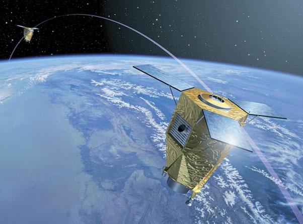
Pléiades, SPOT-6 and -7: new satellite generation will optimise relief efforts
The geodata analysed by Kranz's research team was recorded by the Earth observation satellites SPOT-5 and Terra-SAR-X. Astrium GEO-Information Services (formerly Spot Image and Infoterra) is responsible for the commercial use of the data from both satellites. The EADS subsidiary is set to expand its portfolio shortly to include four new satellites. “The Pléiades constellation and the next generation of SPOT satellites will be launched some time between the end of this year and 2014,” explains Sales Director Marco Weber. “Working together in space, the satellites can cover an area of interest every 12 hours, capturing more than 7 million square kilometres a day,” says Weber, explaining just one of the pioneering aspects that will enable rescue services to respond faster and even more effectively in future.
Like many other renowned companies, Astrium uses INTERGEO – the world's leading fair for geodesy, geoinformation and land management – as an annual platform for presenting new developments and services and for discussing future solutions at the conference.
DVW e.V. – the German Society for Geodesy, Geoinformation and Land Management – is the patron of INTERGEO, which is being held from 27 to 29 September 2011 in Nuremberg. Image material and other information can be found at www.intergeo.de.
The subsidiary HINTE Marketing & Media GmbH offers comprehensive marketing and PR services in addition to trade fair communication.
HINTE Event-Services GmbH ensures the independent organisation of events in their entirety.
Since the end of 2009, fair network GmbH has been working with German and Swiss trade fair specialists to develop innovative ideas in the B2C sector.
Key figures:
Project year: 2009/2010
Trade fairs: 9
National: 8
Exhibitors: 2,700
Visitors: 230,000
HINTE GmbH
Bannwaldallee 60
76185 Karlsruhe, Germany
Telefon: +49 (0)721 931 33-0
Press contact:
HINTE GmbH
Ursula Rubenbauer
Tel.: +49 (0)721/831 424-460
E-mail: urubenbauer@hinte-messe.de
This release was published on openPR.
Permanent link to this press release:
Copy
Please set a link in the press area of your homepage to this press release on openPR. openPR disclaims liability for any content contained in this release.
You can edit or delete your press release Natural disaster in Japan emphasises need for international networking among geo experts here
News-ID: 168645 • Views: …
More Releases from HINTE GmbH

INTERGEO 2011 – Round Table: Galileo indispensable to pioneering application a …
Karlsruhe, 10 June 2011. Experts attending the INTERGEO Round Table in Karlsruhe, Germany, made it infinitely clear that the European satellite programme Galileo is essential. The unanimous conclusion was that Europe must be independent of other referencing systems such as America's GPS and Russia's GLONASS if it is to safeguard its future as a hub for research and business. The patron of INTERGEO, DVW e.V. – the German Society for…

INTERGEO 2011 - Conference opens with new format for the open data community
Karlsruhe, 4 May 2011. The number of members currently stands at 389,302. And it's not just the number of mappers that is increasing. The importance of the global OpenStreetMap (OSM) community is also rising steadily. The OSM project is therefore enjoying heightened interest at INTERGEO, which will be held in Nuremberg from 27 to 29 September 2011, and is the topic of the first ever INTERGEO BarCamp. The broad-based and…

INTERGEO 2011: Geo is the key
Karlsruhe, 28 February 2011. Last year's INTERGEO sent out clear growth signals and encouraged exhibitors and visitors alike to look forward to the next event from 27 – 29 September 2011 in Nuremberg. INTERGEO 2011 will showcase trends and developments that emerged last year. “From 3D developments to satellite applications, the number of increasingly complex systems and solutions is growing all the time, the range of offerings is becoming broader…

Detailed final report INTERGEO 2010
Clear growth signals from the trade fair: “Business is better than was predicted a year ago”
Karlsruhe/Cologne, 10 November 2010. Dr. Hartmut Rosengarten gave a concise summary of the three days of INTERGEO in Cologne: Whereas the focus in 2009 was on “Geo is in”, the talk among industry representatives this year was of “Geo is interconnecting”. The Chairman of the INTERGEO Exhibitor Advisory Board also emphasised that geodata is a…
More Releases for INTERGEO
World-leading' communication forum INTERGEO celebrates its 25th anniversary.
In 2019, the 'world-leading' communication forum INTERGEO celebrates its 25th anniversary. On September 17th Jelvix will witness more than 680 exhibitors all over the world, providing insights into ground-breaking developments and projects in a dynamic geo-IT sector.
"Intergeo 2019"
INTERGEO is an international exhibition for innovative products, technologies, applications and services from the pioneering geoinformation and geodesy sectors.
"Jelvix" always stays on top of the latest technological innovations in different sectors and finds…
INTERGEO 2011 – Round Table: Galileo indispensable to pioneering application a …
Karlsruhe, 10 June 2011. Experts attending the INTERGEO Round Table in Karlsruhe, Germany, made it infinitely clear that the European satellite programme Galileo is essential. The unanimous conclusion was that Europe must be independent of other referencing systems such as America's GPS and Russia's GLONASS if it is to safeguard its future as a hub for research and business. The patron of INTERGEO, DVW e.V. – the German Society for…
INTERGEO 2011 - Conference opens with new format for the open data community
Karlsruhe, 4 May 2011. The number of members currently stands at 389,302. And it's not just the number of mappers that is increasing. The importance of the global OpenStreetMap (OSM) community is also rising steadily. The OSM project is therefore enjoying heightened interest at INTERGEO, which will be held in Nuremberg from 27 to 29 September 2011, and is the topic of the first ever INTERGEO BarCamp. The broad-based and…
INTERGEO 2011: Geo is the key
Karlsruhe, 28 February 2011. Last year's INTERGEO sent out clear growth signals and encouraged exhibitors and visitors alike to look forward to the next event from 27 – 29 September 2011 in Nuremberg. INTERGEO 2011 will showcase trends and developments that emerged last year. “From 3D developments to satellite applications, the number of increasingly complex systems and solutions is growing all the time, the range of offerings is becoming broader…
Detailed final report INTERGEO 2010
Clear growth signals from the trade fair: “Business is better than was predicted a year ago”
Karlsruhe/Cologne, 10 November 2010. Dr. Hartmut Rosengarten gave a concise summary of the three days of INTERGEO in Cologne: Whereas the focus in 2009 was on “Geo is in”, the talk among industry representatives this year was of “Geo is interconnecting”. The Chairman of the INTERGEO Exhibitor Advisory Board also emphasised that geodata is a…
Global Citizen Award winner 2010 Jack Dangermond at INTERGEO in Cologne
Can GIS on the Internet help to resolve the most pressing problems facing the Earth? That and others were the questions that ESRI President Jack Dangermond discussed at INTERGEO 2010 in Cologne.
Climate change, environmental damage, the vulnerable biodiversity of the blue planet, the protection of ecosystems, clean energy sources and cities that are good places to live – according to the Californian boss of the world’s largest GIS
software developer, ESRI,…
