Press release
Automatic generation of 3D city models at the CeBIT 2011
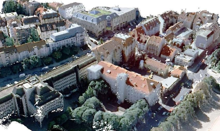
tridicon 3D uses stereo aerial imagery or LiDAR data to generate 3D city models.From March 1st until 5th at the CeBIT 2011 in Hannover, Germany, GTA Geoinformatik GmbH proudly presents its new software solution tridiconTM 3D for the automatic generation of 3D city models.
In an automatic process tridiconTM 3D delivers high quality models in level of detail 2 (LOD 2) from stereo aerial imagery. Other suitable data sources are LiDAR data (airborne laserscanning) and stereo satellite imagery. Furthermore a digital terrain model and building footprints are used.
tridiconTM 3D enables commercial users, municipalities and state offices to produce high quality 3D city models in LOD 2 fast, area-wide and cost-effectively.
Also presented will be new ways to texture 3d city models with procedural 3D façades as well as automatic façade recognition.
Additional modules complete the software solution regarding data management, update and editing, analysis and visualisation of 3D city models.
On request data of interested companies or municipalities will be tested regarding their suitability.
Contact GTA directly to make an appointment for a live demonstration and to get your free ticket via contact@tridicon.de.
Meet GTA at CeBIT 2011 in Hannover! You will find GTA at the booth of IT Initiative MV, Hall 9, Booth C09.
The company - GTA Geoinformatik GmbH
tridiconTM is a software solution developed by GTA Geoinformatik GmbH. Founded in 1991, the company belongs to the technology leaders in digital photogrammetry, aerial mapping and the generation of 3D city models. GTA’s head office is in Neubrandenburg (Mecklenburg-Vorpommern), a second office is in Berlin.
GTA Geoinformatik GmbH
Managing director: Dr. Peter Lieckfeldt
Lindenstraße 63, D-17033 Neubrandenburg
Phone: +49 395 3581 142
Fax: +49 395 3684 424
Email: contact@tridicon.de
Internet: www.tridicon.de
Marketing contact: Kathrin Hutton
hutton@gta-geo.de, Tel. +49 395 3581 238
This release was published on openPR.
Permanent link to this press release:
Copy
Please set a link in the press area of your homepage to this press release on openPR. openPR disclaims liability for any content contained in this release.
You can edit or delete your press release Automatic generation of 3D city models at the CeBIT 2011 here
News-ID: 161822 • Views: …
More Releases from GTA Geoinformatik GmbH
New Software Solution for Automatic Point Cloud Generation and 3D Modelling from …
GTA Geoinformatik GmbH presents new 3D software solutions at COM.GEO 2012 in Washington D.C.
Fully automated generation of very dense 3D point clouds and Digital Surface Models (DSM) from stereo aerial images (nadir and oblique) seems to become more and more important. Most efficiently this is done using semi global matching (SGM) algorithms. With the software release tridicon® PointCloud GTA offers a new tool that produces accurate point clouds for…

Breakthrough in Automatic Analysis of Aerial Images with Computer Stereo Vision
GTA Geoinformatik GmbH presents revolutionary new technology for automatic 3D object reconstruction without help of any 2D map data at CeBIT 2012
At this years CeBIT in Hannover dated 06th to 10th March GTA for the first time presents a prototype of a new tridicon® software version, that enables the detection of 3D objects like buildings without the need for 2D vector data (e. g. building outlines). The only source…
New Possibilities in Digitizing Aerial Images - Enhance Safety and Usability of …
Most larger municipalities or government agencies as well as many privately owned companies from the geodata sector own a large archive of aerial imagery on film. These archives contain a value of many ten thousands of dollars which is hardly used or recognized. Today's scanning technology together with up to date software tools and data storage systems make possible a much higher scanning resolution than only few years ago. Where…
High-Quality 3D Modelling Using Georeferenced Photography
Production of georeferenced digital 3D landmarks from terrestrial photography using the software suite tridicon® 3D LANDMARK
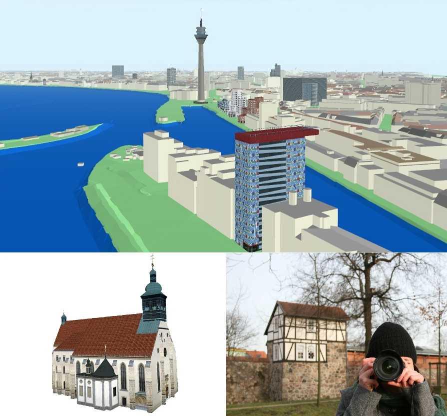
Digital 3D city models become very popular. Internet maps and car navigation are much more user-friendly when using 3D visualisation. Many municipalities use 3D city models for applications in town and environmental planning, for noise control management, for solar panel assessments or for marketing purposes. New technologies like 3D printing allow the fast and cost-efficient…
More Releases for LiDAR
LiDAR Market Report 2024 - LiDAR Market Demand, Growth, And Segments
"The Business Research Company recently released a comprehensive report on the Global LiDAR Market Size and Trends Analysis with Forecast 2024-2033. This latest market research report offers a wealth of valuable insights and data, including global market size, regional shares, and competitor market share. Additionally, it covers current trends, future opportunities, and essential data for success in the industry.
Ready to Dive into Something Exciting? Get Your Free Exclusive Sample of…
Automotive LiDAR Market Is Booming Worldwide | Benewake, Garmin, Velodyne Lidar
The "Automotive LiDAR Market" intelligence report, just published by USD Analytics Market, covers a micro-level study of important market niches, product offers, and sales channels. to determine market size, potential, growth trends, and competitive environment, the Automotive LiDAR Market provides dynamic views. Both primary and secondary sources of data were used to generate the research, which has both qualitative and quantitative depth. Several of the major figures the study featured…
LiDAR drone: Illuminating Landscapes through LiDAR-enabled Aerial Mapping
The aerial remote sensing defends critical infrastructure such as airports, banks, government buildings, and military bases among others. The fixed-wing type of drones offer prompt, unfailing, and efficient services to police and military forces since they need to be ready to react to any case quickly and make quick and relevant information. This type of drone is lucrative option compared to manhours and help to make certain public safety during…
LiDAR Technology Market May See a Big Move | Trimble, Velodyne Lidar, YellowScan
Latest Study on Industrial Growth of Global LiDAR Technology Market 2022-2028. A detailed study accumulated to offer Latest insights about acute features of the LiDAR Technology market. The report contains different market predictions related to revenue size, production, CAGR, Consumption, gross margin, price, and other substantial factors. While emphasizing the key driving and restraining forces for this market, the report also offers a complete study of the future trends and…
LiDAR Drones Market Astonishing Growth with Top Influencing Key Players like Vel …
The LiDAR drones market was valued at USD 74.96 million in 2020, and is projected to reach a value of USD 525.86 million by 2026, recording a CAGR of 38.19% over the forecast period (2021 - 2026).
Latest research on LiDAR Drones Market report covers forecast and analysis on a worldwide, regional and country level. The study provides historical information of 2016-2021 together with a forecast from 2022 to 2026 supported…
LiDAR Drones Market 2021 Strategic Assessment- Velodyne LiDAR Inc., Phoenix LiDA …
Global LiDAR Drones Market This market research provides an analysis of the most important trends expected to impact the market outlook during the forecast period. Research classifies an emerging trend as a major factor that has the potential to significantly impact the market and contribute to its growth or decline.
In 2019, the LiDAR drones market was valued at USD 38.16 million, and is projected to reach a value of USD…
