


Press release
Why Architects Use Point Cloud to BIM for Existing Buildings
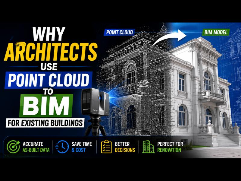
Renovating or restoring an existing building is rarely straightforward. Walls shift over decades. Original drawings go missing. Structural modifications get made without documentation. For architects, working with existing conditions means confronting a level of uncertainty that simply doesn't exist in new construction.
That's where Point Cloud to BIM conversion services (https://www.chudasamaoutsourcing.com/service/scan-to-bim/) come in. By capturing a building's physical reality with millimeter-level precision and converting that data into an intelligent 3D model, architects can plan projects with far greater confidence. The workflow has transformed how professionals approach everything from heritage preservation to commercial retrofits-and adoption is accelerating fast.
This post breaks down exactly what point cloud technology and BIM are, how the conversion workflow operates, and why more architects are making it a standard part of their process for existing buildings.
What Is Point Cloud Technology?
A point cloud is a dense collection of data points in three-dimensional space, each captured by a laser scanner or photogrammetry system. When a scanner sweeps across a building, it records millions of precise coordinate measurements per second, collectively forming a highly detailed digital snapshot of the physical environment.
Modern laser scanners-like those from Leica Geosystems or FARO Technologies-can capture surfaces with accuracy down to 1-2mm. The resulting point cloud acts as a true-to-life digital twin of the existing structure, preserving every curve, recess, and irregularity.
How are point clouds captured?
There are two primary capture methods:
- Terrestrial laser scanning (TLS): A tripod-mounted scanner rotates to capture the surrounding environment. Best for interior spaces and building facades.
- Photogrammetry: Multiple overlapping photos are processed through software to generate a 3D model. More accessible but typically less precise than TLS.
For most architectural projects involving existing buildings, terrestrial laser scanning remains the gold standard due to its superior accuracy and data density.
Understanding BIM for Existing Buildings
Building Information Modeling (BIM) is a digital process that creates intelligent, data-rich 3D models of buildings. Unlike traditional 2D drawings, a BIM model contains layered information about structural elements, MEP systems, materials, and spatial relationships-all in a single, coordinated environment.
For new construction, BIM is now widely adopted across the industry. But its value for existing buildings is equally compelling, and arguably more complex to execute.
Traditional documentation methods-tape measures, hand sketches, and legacy CAD drawings-introduce human error and rarely capture the full complexity of an existing structure. BIM changes this. When built from accurate point cloud data, a BIM model reflects the building as it actually stands today, not how it was originally designed.
Key advantages of BIM for renovation and restoration projects
- Coordination across disciplines: Architects, structural engineers, and MEP contractors can work from a single federated model, reducing conflicts and costly site surprises.
- Clash detection: BIM software identifies spatial conflicts between building systems before construction begins.
- Renovation planning: Accurate 3D models allow design teams to test interventions virtually before committing to physical work.
- Improved client communication: 3D visualizations are far more intuitive for clients than 2D drawings, especially when communicating complex restoration or reuse proposals.
The Point Cloud to BIM Workflow
Converting raw scan data into a usable BIM model involves several distinct stages, each requiring technical skill and quality oversight.
Step 1 - Scanning and data capture: The building is scanned from multiple positions to eliminate blind spots. Scan stations are registered together to form a single, unified point cloud.
Step 2 - Point cloud processing: Software such as Autodesk ReCap or Leica Cyclone is used to clean, align, and manage the raw scan data, removing noise and optimizing the dataset for modeling.
Step 3 - BIM modeling: Modelers trace the point cloud geometry in software like Autodesk Revit, building out walls, floors, ceilings, structural elements, and MEP systems as intelligent BIM objects.
Step 4 - Quality assurance: The completed model is checked against the original point cloud to verify dimensional accuracy. LOD (Level of Development) standards-such as LOD 200, 300, or 400-are used to define the required precision for each project.
Firms offering Point Cloud to BIM conversion services, such as Chudasama Outsourcing, manage this end-to-end process with dedicated teams of scan-to-BIM specialists, ensuring consistent accuracy and delivery timelines for architecture firms of all sizes.
Why Architects Prefer Point Cloud to BIM
How does point cloud to BIM reduce measurement time and project costs?
Traditional measured surveys of a large building can take days or weeks, with multiple site visits required to resolve gaps or conflicts in the data. A laser scan of the same building can be completed in hours, with no return trips needed. This alone represents a significant reduction in both time and cost.
Beyond speed, the accuracy of scan data eliminates the rework that often follows when hand measurements turn out to be wrong mid-project.
How does point cloud data handle complex geometries in existing buildings?
Existing buildings frequently contain curved walls, irregular openings, vaulted ceilings, and structural elements that have shifted over time. These features are extremely difficult to capture accurately using manual methods. Point cloud scanning records every surface exactly as it exists, regardless of complexity-making it particularly valuable for heritage buildings, where geometric irregularity is the norm rather than the exception.
What role does BIM play in improving renovation estimates?
With a dimensionally accurate BIM model, quantity surveyors and contractors can extract reliable material takeoffs directly from the model. This reduces estimation errors and gives project teams a much stronger foundation for budgeting renovation work-particularly important for adaptive reuse projects where scope uncertainty is high.
Real-World Applications
Heritage building preservation: Scan-to-BIM is now standard practice for protecting and restoring significant structures. Institutions like the Vatican Museums and Notre-Dame de Paris have used laser scanning to document their buildings in extraordinary detail, enabling restoration teams to plan work with precision that would have been impossible otherwise.
Commercial renovation and modernization: Office buildings undergoing full fit-out renovations benefit significantly from scan-to-BIM. Accurate documentation of existing MEP systems, structural columns, and ceiling heights ensures new design interventions integrate seamlessly with the existing fabric.
Adaptive reuse projects: Converting industrial warehouses, historic factories, or disused civic buildings into new uses requires a deep understanding of the existing structure. Point cloud data gives architects the confidence to propose bold design moves, knowing their models reflect physical reality.
Challenges and How to Overcome Them
Like any technical workflow, point cloud to BIM conversion comes with challenges.
- Data volume: High-density scans generate enormous file sizes that can slow software performance. The solution is to work with decimated point clouds during modeling and reference the full dataset only when needed.
- Shadowed areas: Scanners capture only what is in direct line of sight. Obstructions like furniture or machinery can create gaps. Experienced scan teams minimize this by planning station positions carefully and scanning from multiple angles.
- Interpretation decisions: Modelers must make informed decisions about how to represent irregular surfaces in BIM. Clear project briefs, defined LOD requirements, and experienced modeling teams-like those at Chudasama Outsourcing (https://www.chudasamaoutsourcing.com/) are essential for maintaining consistency and accuracy throughout the process.
The Future of Point Cloud to BIM in Architecture
Point cloud to BIM has moved from a niche workflow to an industry standard-and for good reason. The combination of laser scanning precision and BIM intelligence gives architects the tools to tackle existing building projects with a level of clarity and confidence that traditional methods simply cannot match.
Looking ahead, advances in automated scan-to-BIM conversion-driven by machine learning and AI-assisted feature recognition-will continue to reduce processing times and increase model accuracy. Mobile scanning devices are also making the capture phase more accessible and cost-effective for smaller projects.
For architects working with existing buildings today, adopting this workflow isn't just about efficiency. It's about delivering better outcomes-more accurate designs, fewer construction surprises, and stronger collaboration across the project team. Partnering with experienced providers of Point Cloud to BIM conversion services is the most direct path to making that happen.
Frequently Asked Questions
What is the difference between point cloud scanning and traditional measured survey?
A traditional measured survey relies on manual tape measurements, hand sketches, and laser distance meters to document a building. Point cloud scanning uses a laser scanner to capture millions of precise 3D coordinates in minutes, producing a far more accurate and complete record of existing conditions with less time spent on site.
What software is used for point cloud to BIM conversion?
The most widely used tools include Autodesk ReCap for point cloud processing, Autodesk Revit for BIM modeling, and Leica Cyclone or FARO Scene for scan registration. The specific toolset depends on project requirements, the scan hardware used, and the modeling team's workflow.
How accurate is a point cloud to BIM model?
When captured with a professional-grade laser scanner and modeled to appropriate LOD standards, a scan-to-BIM model typically achieves accuracy within 1-5mm of the physical building. Accuracy depends on scanner quality, environmental conditions, and the skill of the modeling team.
What types of buildings benefit most from scan-to-BIM?
Existing buildings with complex geometry, limited original documentation, or significant renovation scope benefit most. This includes heritage structures, commercial buildings undergoing modernization, and industrial buildings being converted to new uses.
How long does the point cloud to BIM process take?
Timelines vary based on building size and complexity. A mid-sized commercial floor plate might be scanned in half a day and modeled within one to two weeks. Larger or more complex projects will take longer. Engaging a specialist Point Cloud to BIM conversion services provider like Chudasama Outsourcing can accelerate delivery significantly.
A-601/2, Siddhivinayak Business Towers, Nr. Kataria House, Makarba, Ahmedabad, Gujarat
Email ID - info@chudasamaoutsourcing.com
Website - www.chudasamaoutsourcing.com
Chudasama Outsourcing is a leading architecture firm based in the USA. We specialize in providing top-notch services including architectural BIM modeling, Scan to BIM, CAD drawings, shop drawings, structural detailing, CAD conversion, MEP drawings, BIM coordination, clash detection, 3D modeling, 3D rendering, PDF to CAD conversion, CAD to BIM conversion, and family creation services. Our team boasts extensive experience and expertise in these areas.
This release was published on openPR.
Permanent link to this press release:
Copy
Please set a link in the press area of your homepage to this press release on openPR. openPR disclaims liability for any content contained in this release.
You can edit or delete your press release Why Architects Use Point Cloud to BIM for Existing Buildings here
News-ID: 4594905 • Views: …
More Releases from Chudasama Outsourcing
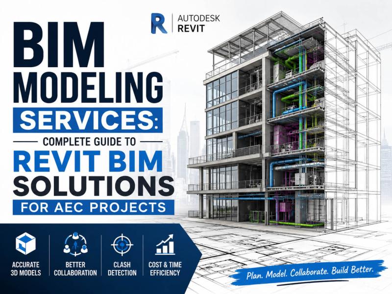
BIM Modeling Services: Complete Guide to Revit BIM Solutions for AEC Projects
Modern construction projects demand accuracy, collaboration, and efficiency from concept through construction. BIM (Building Information Modeling) enables architects, engineers, contractors, and developers to work with intelligent 3D models that improve coordination, reduce errors, and support informed decision-making throughout the project lifecycle.
At Chudasama Outsourcing, we provide professional BIM Modeling Services (https://www.chudasamaoutsourcing.com/service/bim-services/) tailored for Architecture, Engineering, and Construction (AEC) firms across the USA, Canada, UK, and Australia. Our experienced BIM specialists develop…

Why BIM Modeling Services in Texas Are Essential for Construction Projects
Texas skylines are transforming at an unprecedented rate. From the sprawling commercial hubs of Houston to the rapidly expanding tech corridors of Austin, cranes dot the horizon. This massive population boom brings a surge in infrastructure, commercial, and residential developments. Builders face immense pressure to deliver high-quality structures on time and within strict budgets.
Traditional 2D blueprints and siloed communication methods frequently fall short under these demanding conditions. Project managers often…
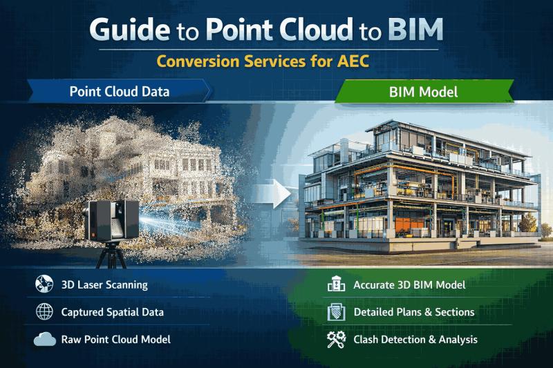
Guide to Point Cloud to BIM Conversion Services for AEC
Architecture, engineering, and construction (AEC) professionals face mounting pressure to deliver projects faster, cheaper, and with higher precision. One of the most effective ways to meet these demands is by bridging the gap between physical spaces and digital models.
Point cloud technology captures the physical world with stunning accuracy, while Building Information Modeling (BIM) turns that data into actionable, intelligent 3D models. When you combine the two, you unlock a powerful…
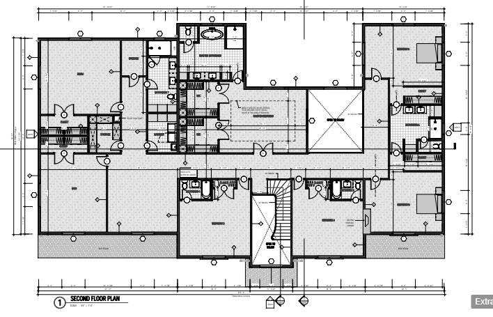
How to Choose the Right Construction Documentation Services
A building is only as stable as its foundation, and a construction project is only as successful as its documentation. When plans are clear, specifications are accurate, and models are clash-free, the construction phase moves smoothly. When they aren't, you face expensive change orders, schedule delays, and frustrating disputes on the job site.
Many architects, engineers, and developers turn to external providers for construction documentation services (https://www.chudasamaoutsourcing.com/service/construction-documentation) to handle the heavy…
More Releases for BIM
Eagle BIM Expands Healthcare BIM Services for Texas Hospital Projects
Texas-based BIM services provider strengthens support for hospitals, medical campuses, and healthcare construction teams with MEP BIM services, clash detection, Revit modeling, scan to BIM, and shop drawing services.
PFLUGERVILLE, Texas, May 2026 - Eagle BIM, a professional BIM services provider in Texas operating in association with BIMPRO LLC, today announced the expansion of its healthcare BIM services for hospitals, medical campuses, outpatient facilities, specialty clinics, and healthcare renovation projects across…
Eagle BIM Expands BIM Services in Texas for AEC Firms Nationwide
PFLUGERVILLE, TX - Eagle BIM, a professional Building Information Modeling (BIM) firm operating in association with BIMPRO LLC, today announced the expansion of its full-suite BIM services to architects, engineers, general contractors, and project owners across Texas and the United States. With a proven track record of delivering coordinated, build-ready models and construction documents, Eagle BIM is positioned as the region's premier single-source BIM consulting and modeling partner.
Headquartered in Pflugerville,…
Elevating Construction with BIM to BIM Studio's Smart BIM Services
Bim to Bim Studio is transforming the AEC industry with advanced Building Information Modeling (BIM) solutions. Our expert team offers BIM modeling, clash detection, 4D/5D scheduling, and MEP coordination services, helping construction companies streamline their projects with precision and efficiency.
With a client-focused approach, we deliver customized BIM strategies for architects, engineers, and contractors across the globe. Whether it's a large commercial project or a detailed infrastructure plan, Bim to Bim…
Insights into the BIM Modeling Services Market 2025: Healthy CAGR and Business S …
The worldwide "BIM Modeling Services Market" 2025 Research Report presents a professional and complete analysis of the Global BIM Modeling Services Market in the current situation. This report includes development plans and policies along with BIM Modeling Services manufacturing processes and price structures. the reports 2025 research report offers an analytical view of the industry by studying different factors like BIM Modeling Services Market growth, consumption volume, Market Size, Revenue,…
Tejjy Expands Architectural BIM Workforce Amid Growing Demand for BIM Services
Tejjy, being one of the leading architectural BIM and VDC services provider in Maryland, is looking forward to expanding its workforce to meet the rising Architectural BIM demand.
Expanding Team to Meet Industry Needs
Currently the company is actively seeking professionals skilled in various BIM roles, including:
MEP Modeler
Mechanical BIM Coordinator
BIM Architectural Designer
BIM engineer
The company's recent surge in federal and commercial projects necessitates…
Revit BIM Modeling Services and BIM Outsourcing Market Growth Drivers, and Compe …
Worldwide Market Reports announces the publication of its most recently generated research report titled, "Revit BIM Modeling Services and BIM Outsourcing Market - Forecast to 2030", which offers a holistic view of the Revit BIM Modeling Services and BIM Outsourcing market through systematic segmentation that covers every aspect of the target market. Revit BIM Modeling Services and BIM Outsourcing with 100+ market data Tables, Pie Chat, Graphs, and Figures spread…

