Press release
Geospatial Imagery Analytics Market Size Accelerating at 14.8% CAGR | By Keyplayers: Maxar Technologies, Planet Labs, Airbus Defence & Space, Hexagon AB, Trimble Inc., Esri

Geospatial Imagery Analytics Market
Get | Download Sample Copy with TOC, Graphs & List of Figures @ https://www.verifiedmarketreports.com/download-sample?rid=883004&utm_source=Openpr-NSL-April26&utm_medium=308
This market research deliverable provides institutional-grade insights into capital allocation strategies, competitive benchmarking, and forward-looking valuation models. The report is structured for seamless integration into private equity due diligence workflows and sovereign wealth investment frameworks. Delivered through a combination of data visualization dashboards, scenario-based forecasting, and AI-powered intelligence briefs, it enables investors to identify high-growth subsectors, assess geopolitical risk exposure, and evaluate acquisition targets with precision.
What are the key investment insights shaping the Geospatial Imagery Analytics Market outlook between 2026 and 2033?
The geospatial imagery analytics market is entering a high-growth phase driven by defense digitization, climate monitoring, and smart infrastructure investments. Institutional capital is increasingly flowing into satellite constellations, AI-driven analytics platforms, and cloud-based geospatial services. The convergence of big data analytics and geospatial intelligence is unlocking new revenue streams across sectors including agriculture, urban planning, and disaster management.
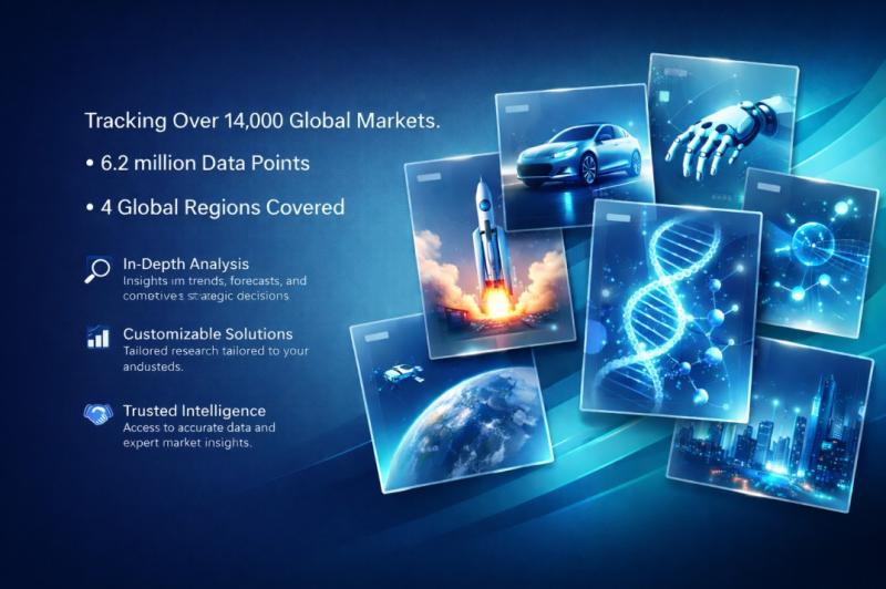
Market size (2024): $9.6 Billion
Forecast (2033): $28.4 Billion
CAGR 2026-2033: 14.8%
Leading Segments: Satellite imagery dominates due to defense and climate applications
Key Application/technology: AI-powered object detection and predictive geospatial modeling
Key Regions/Countries with market share: United States leads with over 38% share followed by China and Europe
Where are the most attractive capital deployment opportunities in the Geospatial Imagery Analytics Market today?
High-return opportunities are concentrated in vertically integrated satellite operators, AI-based analytics platforms, and SaaS geospatial intelligence providers. Venture capital and private equity firms are targeting companies with proprietary datasets and scalable cloud architectures. The rise of defense-tech unicorns has further intensified deal activity, with strategic buyers acquiring niche analytics startups to enhance capabilities in predictive intelligence and autonomous navigation.
Emerging opportunities include precision agriculture analytics, ESG monitoring solutions, and urban digital twin platforms. Investors are prioritizing companies that offer recurring revenue models and high-margin data subscription services. Cross-border M&A is accelerating as US-based firms seek technological advantages and global data coverage.
What macro and micro trends are redefining the Geospatial Imagery Analytics Market landscape?
Several structural trends are reshaping the market. First, the commercialization of space has lowered entry barriers, enabling private firms to deploy satellite constellations. Second, the integration of AI and machine learning is transforming raw imagery into actionable intelligence at scale. Third, the proliferation of IoT devices is increasing demand for real-time geospatial data integration.
Additionally, climate change monitoring and ESG compliance requirements are driving adoption among governments and corporations. The increasing frequency of natural disasters has amplified the need for rapid-response geospatial analytics. These trends collectively enhance the long-term growth trajectory and investment attractiveness of the sector.
How will artificial intelligence unlock value creation in the Geospatial Imagery Analytics Market?
Artificial intelligence is the core value driver in this market, enabling automated image recognition, anomaly detection, and predictive analytics. AI algorithms significantly reduce processing time and operational costs, improving scalability and profitability. Advanced deep learning models are capable of identifying patterns across massive datasets, enabling predictive insights for defense, agriculture, and infrastructure planning.
AI also addresses key challenges such as data overload and latency. By automating data interpretation, companies can deliver real-time insights to end-users. This enhances decision-making efficiency and creates strong competitive moats for technology leaders. Institutional investors are increasingly valuing firms with proprietary AI capabilities and robust data pipelines.
What regional dynamics are influencing growth patterns in the Geospatial Imagery Analytics Market?
The United States remains the dominant market due to high defense spending, advanced satellite infrastructure, and strong presence of leading technology firms. Federal agencies and defense departments are major consumers, driving consistent demand for high-resolution imagery and analytics services.
Asia-Pacific is the fastest-growing region, led by China and India, where government initiatives and smart city projects are accelerating adoption. Europe is witnessing steady growth driven by environmental monitoring and regulatory compliance requirements. Middle East markets are emerging as strategic hubs due to increasing investments in defense and infrastructure analytics.
How is the Geospatial Imagery Analytics Market segmented and where are the highest-margin segments?
The market is segmented based on type, application, and end-user industries. Satellite imagery remains the dominant segment due to its extensive use in defense and environmental monitoring. Aerial imagery and drone-based analytics are gaining traction in commercial applications such as construction and agriculture.
Application-wise, defense and intelligence dominate revenue contribution, followed by urban planning and disaster management. Commercial sectors such as agriculture, mining, and logistics are emerging as high-growth segments. These applications offer strong margins due to subscription-based models and data monetization opportunities.
End-user segmentation includes government agencies, defense organizations, and private enterprises. Government contracts provide revenue stability, while enterprise adoption drives scalability and innovation. Investors are focusing on companies with diversified end-user portfolios to mitigate risk and enhance valuation multiples.
By Technology - Optical Satellite Imagery, Radar Satellite Imagery, LIDAR (Light Detection and Ranging), Infrared Imaging, Thermal Imaging
By Application - Agriculture Monitoring, Urban Planning and Development, Environmental Monitoring, Disaster Management and Recovery, Defense and Intelligence, Transportation and Logistics
By End-User Industry - Government, Aerospace and Defense, Energy and Utilities, Forestry and Agriculture, Telecommunications, Mining and Natural Resources
By Data Source - Satellite Imagery, Aerial Imagery, Ground-Based Imagery, Drone Imagery, Mobile Mapping Systems
By Service Type - Data Acquisition, Data Processing, Data Analysis, Custom Mapping Solutions, Consulting and Support Services
By Geography - North America, Europe, APAC, Middle East Asia & Rest of World.
Get Discount On The Purchase Of This Report @ https://www.verifiedmarketreports.com/ask-for-discount?rid=883004&utm_source=Openpr-NSL-April26&utm_medium=308
Who are the dominant players and how intense is competition in the Geospatial Imagery Analytics Market?
The competitive landscape is characterized by a mix of established aerospace giants and emerging technology startups. Leading companies are investing heavily in satellite constellations, AI capabilities, and data analytics platforms to maintain competitive advantage. Strategic partnerships and acquisitions are common, as firms seek to expand data coverage and enhance analytical capabilities.
Barriers to entry remain high due to capital-intensive infrastructure and regulatory complexities. However, innovation-driven startups are disrupting traditional models by offering cost-effective and scalable solutions. The market is witnessing consolidation as larger players acquire niche firms to strengthen their technological capabilities and market positioning.
Hexagon, Harris, Digitalglobe, Environmental Systems Research Institute, Google, Trimble, Rmsi, Planet Labs, Urthecast, Fugro, Keyw, Satellite Imaging
People also ask
What is driving demand in the Geospatial Imagery Analytics Market?
Rising defense spending, climate monitoring needs, and smart city initiatives are primary drivers.
Is the Geospatial Imagery Analytics Market a good investment sector?
Yes, it offers strong growth potential, recurring revenue models, and high entry barriers.
Which industries use geospatial imagery analytics the most?
Defense, agriculture, urban planning, and disaster management are key industries.
How does satellite imagery contribute to market growth?
It provides high-resolution data essential for intelligence, surveillance, and environmental monitoring.
What role does AI play in this market?
AI enables automated data analysis, improving efficiency and scalability.
Which region dominates the Geospatial Imagery Analytics Market?
The United States leads due to advanced infrastructure and high defense budgets.
What are the risks associated with this market?
High capital requirements, regulatory constraints, and geopolitical risks.
How are startups impacting the competitive landscape?
They introduce innovative, cost-effective solutions, increasing competition and driving M&A activity.
What is the future outlook for the Geospatial Imagery Analytics Market?
Strong growth is expected, driven by AI integration and increasing data demand.
How do investors evaluate companies in this sector?
Key metrics include data ownership, AI capabilities, revenue models, and contract pipelines.
For More Information or Query or Customization Before Buying, Visit @ https://www.verifiedmarketreports.com/product/global-geospatial-imagery-analytics-market-size-and-forecast-to-2025/
Contact us:
Mr. Edwyne Fernandes
US: +1 (650)-781-4080
US Toll-Free: +1 (800)-782-1768
Website: https://www.verifiedmarketreports.com/
About Us: Verified Market Reports
Verified Market Reports is a leading Global Research and Consulting firm servicing over 5000+ global clients. We provide advanced analytical research solutions while offering information-enriched research studies.
We also offer insights into strategic and growth analyses and data necessary to achieve corporate goals and critical revenue decisions.
Our 250 Analysts and SMEs offer a high level of expertise in data collection and governance using industrial techniques to collect and analyze data on more than 25,000 high-impact and niche markets. Our analysts are trained to combine modern data collection techniques, superior research methodology, expertise, and years of collective experience to produce informative and accurate research.
This release was published on openPR.
Permanent link to this press release:
Copy
Please set a link in the press area of your homepage to this press release on openPR. openPR disclaims liability for any content contained in this release.
You can edit or delete your press release Geospatial Imagery Analytics Market Size Accelerating at 14.8% CAGR | By Keyplayers: Maxar Technologies, Planet Labs, Airbus Defence & Space, Hexagon AB, Trimble Inc., Esri here
News-ID: 4501019 • Views: …
More Releases from Verified Market Reports

Wool Yarn Market Size Surging at 6.8% CAGR | By Key Players: Indorama Ventures, …
The Wool Yarn Market is experiencing a recalibration of supply-demand dynamics due to geopolitical disruptions such as the US-Iran conflict, which has intensified volatility in energy, logistics, and raw material sourcing. Increased fuel costs and trade route uncertainties have elevated transportation expenses for raw wool exports from key producing regions like Australia and New Zealand to manufacturing hubs. This has accelerated nearshoring strategies in the United States and Europe while…

Automotive Convertible Top Market Size Accelerated by 6.7% CAGR | By Key Players …
The geopolitical shockwaves from escalating tensions such as the US-Iran conflict have materially reshaped supply chain economics, raw material sourcing strategies, and capital allocation in the Automotive Convertible Top Market. Disruptions in petrochemical supply chains have directly impacted synthetic fabric pricing, while energy volatility has increased production costs across Tier-1 and Tier-2 suppliers. Investors are witnessing a shift toward nearshoring strategies, supplier diversification, and vertically integrated manufacturing models to mitigate…
Pneumatic Actuator Market Size Accelerating at 6.8% CAGR | By Key Players: Emers …
The escalation of geopolitical tensions, particularly the US-Iran conflict dynamics, has materially reshaped industrial capital allocation and supply chain priorities across energy, defense, and process automation sectors. Heightened volatility in oil and gas markets has driven accelerated investments in upstream and downstream automation infrastructure, directly increasing demand for pneumatic actuators in valve control systems and hazardous environments. Defense modernization programs and critical infrastructure protection initiatives have also intensified procurement cycles,…

Zero Liquid Discharge Systems Market Size Accelerating at 13.9% CAGR | By Key Pl …
The Zero Liquid Discharge Systems Market is being fundamentally reshaped by geopolitical tensions such as the US-Iran conflict, which has amplified volatility in energy prices and industrial production costs. Water-intensive industries including power generation, chemicals, and oil & gas are increasingly prioritizing water reuse and regulatory compliance to mitigate operational risks linked to supply disruptions. Rising energy costs have also intensified the need for energy-efficient ZLD technologies, pushing innovation in…
More Releases for Imagery
How AI Is Changing Furniture Product Imagery
Artificial intelligence is reshaping how furniture brands produce and distribute product imagery. While early AI image generation tools relied primarily on text prompts and probabilistic outputs, newer approaches in furniture visualization are increasingly built on structured 3D models. This distinction is significant. Rather than generating imagery based on interpretation alone, model-based systems create visuals that are controllable, reviewable, and repeatable. The result is not simply faster image production, but a…
OnGeo Intelligence Offers Free Satellite Imagery
OnGeo Intelligence allowing users to access free Satellite Imagery, delivering 10-meter resolution images enhanced to 2.5 meters for global locations. The service also provides high-resolution imagery to 0.3 metres - paid option. Breaking down barriers to advanced geospatial data access.
How it Works?
OnGeo Intelligence simplifies access to satellite imagery through its user-friendly platform. Users select a location and time range, and the system retrieves cloud-free images from a vast archive.…
Satellite Imagery for Precision Farming Market Utilizing Satellite Imagery for P …
The Report on "Satellite Imagery for Precision Farming Market" provides Key Benefits, Market Overview, Regional Analysis, Market Segmentation, Future Trends Upto 2030 by Infinitybusinessinsights.com. The report will assist reader with better understanding and decision making.
Market Growth of Satellite Imagery for Precision Farming Market: The Satellite Imagery for Precision Farming market is experiencing robust growth, driven by trends in high-resolution satellite imaging, AI-driven crop analysis, and the demand for sustainable agriculture…
colossis.io Revolutionizes Travel Marketing with AI-Enhanced Imagery
ALBUQUERQUE, NM, UNITED STATES, April 21, 2023
colossis.io, a leading provider of AI-enhanced travel imagery, is transforming the travel marketing industry with its cutting-edge technology. By leveraging the power of AI, colossis.io is able to elevate hotel and Airbnb photos to new heights, leaving customers in awe.
To take advantage of colossis.io's technology, all you need to do is upload your source imagery and let the AI work its magic. In just…
High-Resolution Multispectral Satellite Imagery Solutions | TELEPIX
TELEPIX provides high-resolution multispectral satellite imagery solutions to the military, intelligence, coast guard, and environment monitoring sectors. TelePIX develops these more cost-effectively than any other company by using lean procedures while maintaining quality and performance.
TelePIX High Resolution Satellite Images Product
MACC (Multi-Aperture Computational Camera)
Super-high resolution reconnaissance micro-satellite based on multi-camera synthetic aperture imaging
Captured images at LEO consists of WFOV(x1) using central camera module and NFOV(x3) using flat cameras with different LOS
MicroSat…
Outstanding Multispectral Satellite Imagery Solution | TELEPIX
TELEPIX provides outstanding multispectral satellite imagery solution in Korea. It offers a next-generation UHR (ultra-high resolution) multispectral EO/IR payload for government, military, intelligence, and space agencies.
TelePIX Multispectral Satellite Imagery
Multispectral satellites are the most affordable way to monitor any location on the planet. They beyond monitoring locations and capturing beautiful images because there is a need for actionable data to make more accurate decisions faster.
The benefits of Multispectral Imagery
Multispectral imagers are…
