Press release
Role of GPS Map Camera in Supporting Agriculture Officers and Outreach Teams
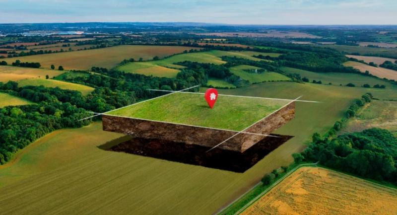
In this process, accurate field documentation becomes essential. GPS Map Camera https://onelink.to/gm-dj-pd-seo supports agriculture officers and outreach teams by improving how field activities are recorded, verified, and reviewed through location- and time-based photo evidence.
Documentation Challenges in Agricultural Field Operations
Agricultural field work is spread across wide and often remote areas. A single officer may visit multiple farms, demonstration plots, or villages in one day. Later, during reporting or scheme evaluation, questions commonly arise:
Which farm or plot was visited?
When was the inspection or outreach activity conducted?
Does the photo actually belong to the reported location?
Normal photos provide visual proof but do not reliably confirm location or timing. This creates uncertainty during reviews and slows down decision-making. GPS Map Camera addresses this challenge by embedding verification details directly into the photo itself.
Use in Crop Inspection and Field Monitoring
Crop inspection is a core responsibility for agriculture officers. Whether monitoring crop health, pest damage, irrigation status, or growth stages, accurate records are required.
GPS Map Camera helps document crop inspections by ensuring that photos clearly show:
Exact field or farm location
Date and time of inspection
On-ground crop condition
These records support comparison over time and help authorities understand field conditions without revisiting sites.
Support for Government Scheme Verification
Agriculture officers are often responsible for verifying government schemes such as crop insurance, subsidy distribution, seed support, soil health programs, and irrigation initiatives. Verification requires proof that activities actually occurred at the reported locations.
GPS Map Camera supports scheme verification by linking photos directly to:
Beneficiary farm locations
Time of field visit
Actual implementation status
This improves transparency and reduces disputes during audits or reviews.
Role in Farmer Outreach and Training Programs
Outreach teams conduct farmer meetings, training sessions, demonstrations, and awareness programs. These activities are evaluated based on reach, location, and participation.
GPS Map Camera helps outreach teams document:
Village or training site location
Date and time of the program
On-ground participation and setup
These records support program evaluation and reporting.
Use in Damage Assessment and Seasonal Reporting
Natural events such as droughts, floods, pests, or storms often require rapid damage assessment. Agriculture officers must document affected areas accurately.
GPS Map Camera supports damage reporting by capturing:
Location-specific damage evidence
Time-bound assessment records
Visual condition of crops or land
These verified records support compensation processing and relief planning.
Improving Accountability and Reducing Reporting Gaps
Agricultural reports are often reviewed by departments, planners, and funding authorities who are not present in the field. GPS Map Camera reduces dependency on written explanations by allowing photos to explain themselves.
This results in:
Fewer clarification requests
Faster report validation
More consistent documentation
Field teams can focus on agricultural support instead of repeated reporting.
Long-Term Traceability of Agricultural Records
Agricultural data is often revisited across seasons or years. GPS Map Camera ensures that photos retain embedded location and time information, even when stored long-term.
This supports:
Historical crop comparison
Program impact analysis
Audit and compliance reviews
Consistency in records improves confidence in agricultural data.
Integration Into Existing Agricultural Workflows
GPS Map Camera does not replace existing agricultural reporting systems. Photos captured using the app can be attached to reports, shared with supervisors, or uploaded to digital platforms already in use.
This makes adoption practical for daily field operations https://onelink.to/gm-dj-pd-seo without additional training or process changes.
Alignment With Digital Agriculture and Data-Based Planning
Modern agriculture increasingly relies on digital records, evidence-based planning, and transparent reporting. GPS Map Camera aligns with this shift by strengthening visual documentation with structured verification.
It supports data accuracy, accountability, and informed decision-making across agricultural programs.
P.O Bagarji Town Bagarji Village Ghumra Thesil New Sukkur District Sukkur Province Sindh Pakistan 65200.
Wiki Blogs News always keeps careful online users to provide purposeful information and to keep belief to provide solution based information.
This release was published on openPR.
Permanent link to this press release:
Copy
Please set a link in the press area of your homepage to this press release on openPR. openPR disclaims liability for any content contained in this release.
You can edit or delete your press release Role of GPS Map Camera in Supporting Agriculture Officers and Outreach Teams here
News-ID: 4496977 • Views: …
More Releases from Wikiblogsnews

The Proper Order to Detail a Car From Start to Finish
One of the most common mistakes new detailers make is not the products they choose, it is the order they use them in. Doing steps out of sequence can undo work you already completed or make later steps harder than they need to be.
The logic behind the correct order is simple once you see it. Every step should either remove contamination or protect the surface, and each one should set…

Best Online Broker in Malaysia: Fees, Markets and Tools Ranked for 2026
Two brokers can both let you buy shares in Maybank and look almost identical in the app store. The difference between them shows up in your account statement a year later. With the FBM KLCI hovering near 1,680 in June 2026 and more Malaysians putting cash to work, picking the best online broker malaysia https://www.moomoo.com/my residents can grow with is worth a careful look. This guide ranks brokers on the…
How Trash Daddy Dumpsters Is Raising the Standard for Dumpster Rentals Across Co …
When most people think about dumpster rental companies, they imagine a simple transaction: a container arrives, waste goes in, and it's collected a few days later.
In reality, the best operators understand that they're helping customers navigate some of life's biggest projects-home renovations, roofing replacements, construction jobs, estate clearances and commercial developments. That's the philosophy behind https://trashdaddydumpsters.com/ , a company that has built its reputation on reliability, transparency and customer service.
Rather…

Travel Technology That Actually Solves Real Problems
Travel has never been more accessible, but it has also become more complex. From navigating unfamiliar cities to managing flight delays, language barriers, lost luggage, and personal security, modern travelers face a wide range of challenges. Fortunately, technology has evolved to address many of these issues, offering practical solutions that make journeys smoother, safer, and less stressful.
However, not every travel gadget or app is genuinely useful. While some technologies are…
More Releases for GPS
Furthrive GPS Review: The Best GPS Collar of 2025
Losing a pet can be heartbreaking, and traditional fences do not always keep curious dogs or cats safe during walks, hikes or backyard play. Furthrive GPS changes that with a smart collar system that tracks location in real time and sets invisible boundaries to prevent escapes. This review breaks down how the device works, what pet owners gain from it, and whether it lives up to the promise of simple,…
GPS Market Potential Surge Evaluating GPS Market Growth Opportunities Ahead - 20 …
In recent years, the global GPS Market has witnessed a dynamic shift, influenced by changing consumer preferences, technological advancements, and a growing emphasis on sustainability. The Research report on GPS Market presents a complete judgment of the market through strategic insights on future trends, growth factors, supplier landscape, demand landscape, Y-o-Y growth rate, CAGR, pricing analysis. It also provides and a lot of business matrices including Porters Five Forces Analysis,…
AirBolt GPS Tracker Reviews USA: Is AirBolt GPS Tracker The World's Smartest GPS …
AirBolt GPS Tracker Reviews USA: Is AirBolt GPS Tracker The World's Smartest GPS Tracker? All You Need To Know About AirBolt GPS Tracker Before You Buy.
Looking for a game-changer in the realm of GPS trackers? Enter the AirBolt GPS, a revolutionary device that transcends the limitations of traditional Bluetooth trackers and bulky GPS units. Boasting four years of dedicated refinement, AirBolt presents a masterpiece of technology that redefines tracking…
Global GPS Equipment Market | Global GPS Equipment Industry | Global GPS Equipme …
GPS or Global Positioning System equipment is used to find the real-time location-based accurate information of any vehicle, or other types of assets. GPS detects the person or vehicle that uses the GPS to track its exact location. The location information is stored & transmitted to others, which are connected by the internet using radio, cellular, or satellite modem embedded in the unit. It comprises a GPS module for receiving…
Global GPS Equipment Market | Global GPS Equipment Industry | GPS Equipment Mark …
Global Positioning System or GPS equipment market comprises of sales of global positioning systems equipment & related services to determine the ground position of an object through GPS satellites. It is a satellite navigation system that transmits accurate signals that allow GPS equipment to decode or measure the desired location of the satellite. These equipments are smaller in size. With the advent of technologies, it has been possible to develop…
Global GPS Fleet Tracking System Market 2020 Industry Analysis by Manufacturers …
The market research report entitled Global GPS Fleet Tracking System Market 2020 by Company, Type and Application, Forecast to 2025 provides analysis on market conditions, trends, capability, key players, opportunities, and geographical analysis. The report proves to be an ultimate solution when it comes to a better understanding of the industry and leads the business growth. The report covers an overview of the segments and sub-segmentations including the product types,…
