Press release
LiveEO Signs A Seven Digit Contract With The European Space Agency For The Twinspector Satellite Constellation

Berlin, Germany - April 14, 2026 - A few weeks after announcing Twinspector, its dedicated satellite constellation for infrastructure monitoring, LiveEO has secured a seven digit funding from the European Space Agency's (ESA) InCubed programme. The funding supports the next phase of development of the Twinspector satellite system and advances a dedicated European capability for infrastructure monitoring and independent access to very high-resolution Earth observation data.
The ESA InCubed programme, an Earth observation programme managed by ESA Φ-lab, supports innovative commercial Earth observation initiatives across Europe. In Germany, participation in the programme is coordinated by the German Space Agency at the German Aerospace Center (DLR) on behalf of the Federal Ministry of Research, Technology and Space (BMFTR).
Twinspector: The First Satellite Constellation Built for Infrastructure Monitoring
Twinspector is the first satellite constellation specifically designed around the operational needs of infrastructure operators. Unlike most optical Earth observation missions, which are typically optimized for general-purpose imaging, Twinspector is tailored to capture long, narrow corridors such as power lines, railways, and pipelines. With a spatial resolution up to 35 cm in 3D-stereo and a wide swath optimized for corridor mapping, Twinspector will deliver very high-resolution imagery for large-scale infrastructure networks.
By using a dedicated imaging approach with two satellites flying in formation, Twinspector will capture stereo data enabling three-dimensional analysis. LiveEO will use this data to measure vegetation height along infrastructure corridors such as power lines or railways and to identify risks like falling trees or excessive growth before they become critical.
Beyond stereo imaging, Twinspector will support wide-area monitoring of infrastructure corridors. LiveEO will leverage this capability to detect surface changes along pipelines, such as construction or excavation activity, helping customers identify third-party risks at an early stage. Wide-area tasking will ensure efficient coverage of large pipeline networks. With on-board AI enabled by multiple Nvidia GPUs in each satellite LiveEO will be able to reduce the latency for infrastructure operators to receive critical observation.
Dedicated Earth Observation Architecture
Twinspector consists of a coordinated two-satellite formation flying in low Earth orbit (LEO), enabling stereo data acquisition at scale. With this approach, LiveEO follows a proven German heritage established by missions such as TanDEM-X (by Airbus & DLR), while bringing a similar concept into the commercial optical domain.
While TanDEM-X demonstrated the potential of formation flying for radar-based global elevation mapping, Twinspector applies similar principles to very high-resolution optical stereo imaging, optimized for operational infrastructure monitoring.
The mission is being developed in collaboration with a consortium of European industrial partners, including Reflex Aerospace, responsible for the satellite platform, Kampf Telescope Optics for the optical payload, and Engineering Minds Munich for the onboard electronics.
Together, they represent a strong German-centered value chain spanning the full system to build the first commercial system delivering better than 50cm optical imagery operated from Germany.
Integrated Data and Analytics for Infrastructure Monitoring
The development of Twinspector is driven by the limitations of existing satellite systems in infrastructure applications. Current solutions often lack the resolution, revisit frequency, or three-dimensional capability required for operational decision-making.
Twinspector addresses this gap by providing stereo data at scale, enabling reliable height measurements along infrastructure corridors, as well as flexible imaging modes ranging from wide-area mono acquisition to targeted stereo imaging. In addition, the system ensures consistent revisit, supporting regular monitoring cycles for large infrastructure networks. The data will feed directly into LiveEO's existing analytics products, including Treeline and SurfaceScout, which are already used by major infrastructure operators such as DB InfraGO AG and E.ON SE, among many others worldwide.
"As climate change increases the frequency and severity of extreme weather events such as wildfires and storms, managing vegetation along critical infrastructure is becoming more important than ever," said Nora Meyer zu Erpen, Head of EO Data at LiveEO. "Twinspector will significantly help scale the use of satellite-based insights for our customers. As a European company, we greatly value the support and collaboration with ESA and the national space agency through the InCubed programme."
ESA Programme Supporting Commercial Innovation
ESA's InCubed programme fosters commercially viable Earth observation technologies and services developed by European industry. Through public-private co-funding and technical guidance, the programme helps companies accelerate the transition from innovative concepts to operational products.
"The InCubed programme supports companies that are transferring innovative Earth observation technologies into practical applications," said Dr. Inés Usandizaga, InCubed Programme Manager at the German Space Agency at DLR. "Initiatives such as Twinspector strengthen Europe's Earth observation ecosystem and demonstrate how satellite data can support real commercial use cases."
Since its launch in 2018, the programme has supported more than 180 projects across the European space sector, contributing to the growth of the commercial Earth observation market.
LiveEO GmbH
Cuvrystraße 3 - 4
10997 Berlin
Germany
About LiveEO
LiveEO is a technology company based in Berlin that provides AI- and satellite-powered solutions for monitoring critical infrastructure and supply chains. Its products help organizations reduce risk, improve resilience, and meet regulatory requirements by transforming Earth Observation data into actionable intelligence. LiveEO supports customers across the energy, transportation, and commodity sectors worldwide, enabling proactive risk management and more secure, sustainable operations.
About ESA InCubed
InCubed stands for 'Investing in Industrial Innovation' and is a public-private partnership co-funding programme run by ESA Φ-lab. It focuses on developing innovative and commercially viable products and services that generate or exploit the value of Earth observation imagery and datasets. The programme supports entrepreneurs and start-ups in rolling out their ideas, providing co-funding, technical and commercial guidance, and access to ESA's unique network and resources.
This release was published on openPR.
Permanent link to this press release:
Copy
Please set a link in the press area of your homepage to this press release on openPR. openPR disclaims liability for any content contained in this release.
You can edit or delete your press release LiveEO Signs A Seven Digit Contract With The European Space Agency For The Twinspector Satellite Constellation here
News-ID: 4470034 • Views: …
More Releases from LiveEO GmbH

LiveEO Launches Social Network to Solve Geolocation Gathering for EUDR
Social networks have revolutionized personal and professional interactions for billions of people. LiveEO is bringing the same transformative approach to supply chain management with its new feature, the Commercial Network.
The platform's user-friendly interface ensures that even the most complex compliance tasks become manageable. By leveraging proven principles, the Commercial Network enables businesses to send invitations, form connections, and securely share geolocation data and documents necessary for compliance with the…
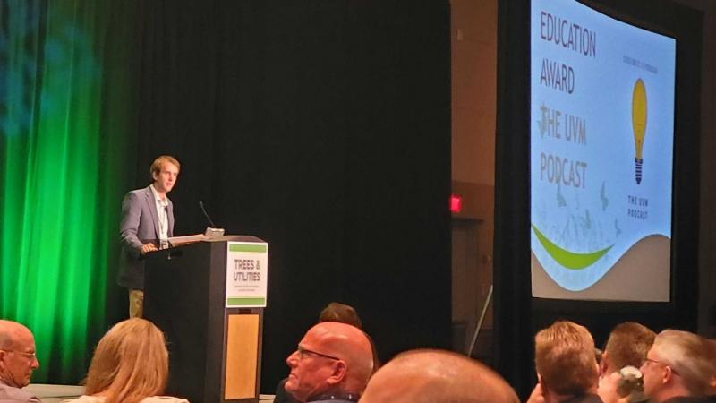
The UVM Podcast Wins Utility Arborist Association Award For Education
The UVM Podcast, launched in 2021, is the original, award-winning and CEU-accredited podcast that focuses on preventing contact between trees and lines, on enhancing the reliability and safety of the world's electric grid. Co-hosted by Steve Cieslewicz, Principal Investigator of the 2003 NE Blackout, and Nick Ferguson, a UVM Technology Leader, The UVM Podcast was this week the recipient of the Utility Arborist Association (UAA) prize for education. The UVM…
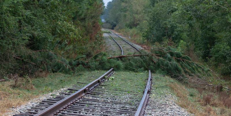
LiveEO announces Rapid Response Insights for Storm Damage
LiveEO will be showcasing their newest product at InnoTrans 2022. An automated rapid response solution based on radar satellite data, Rapid Response Insights works in all weather conditions, pinpointing storm damage locations within hours, so infrastructure operators can restore service without delay.
Fallen trees across rail tracks or downed power lines are dangerous and costly for operators of railways and other linear infrastructure. They can lead to lengthy service interruptions, or…
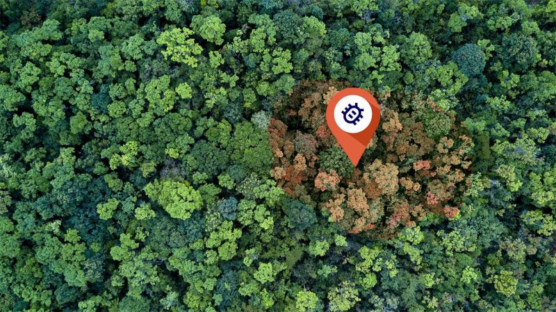
Satellite Analytics Solution for early Bark Beetle Detection Announced
Managing and monitoring forests is challenging. They typically cover vast areas while problems like bug infestations occur locally, with devastating effects to the ecosystem and economic damage to the owners. Satellite analytics and solutions company LiveEO today announced a product based on satellite data and AI that enables forest owners to mitigate those risks.
Recent increases in wood prices that trickled down to countless other industries showed the significance of wood…
