Press release
Aerial Imaging Market to Reach USD 10.96 Billion by 2032 at 14.56% CAGR | North America Leads with 39% Share
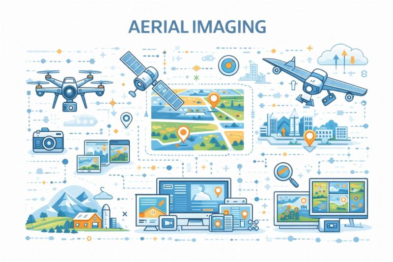
Aerial Imaging Market
Rapid technological advancement is transforming aerial imaging into an intelligent, analytics driven ecosystem supported by artificial intelligence powered image processing, real time mapping, cloud based data platforms, and 3D modeling capabilities. Recent industry momentum includes expanded deployment of drone based surveying for infrastructure development, growing use of precision agriculture imaging to optimize crop yield and resource utilization, and increased integration of thermal and multispectral imaging for security and environmental applications. These innovations are positioning aerial imaging as a foundational technology for smart cities, sustainable resource management, and data driven spatial intelligence worldwide.
Get a Free Sample PDF Of This Report (Get Higher Priority for Corporate Email ID):- https://www.datamintelligence.com/download-sample/aerial-imaging-market?sai-v
Aerial Imaging Market refers to the industry focused on capturing, processing, and analyzing images and data from airborne platforms such as drones, aircraft, and satellites for applications in mapping, surveillance, agriculture, and infrastructure monitoring.
Key Developments
✅ February 2026: In the United States and global commercial sectors, DroneDeploy expanded its aerial imaging software platform with advanced 3D mapping and AI-based analytics tools to support construction, agriculture, and infrastructure inspection workflows.
✅ January 2026: In Europe, Airbus Defence and Space completed in-orbit commissioning of new high-resolution optical imaging satellites that enhance Earth observation capabilities for environmental monitoring and land use analysis.
✅ December 2025: In North America and Asia Pacific, Skyfire Labs introduced upgraded thermal and multispectral aerial imaging sensors for drones used in precision agriculture, search and rescue, and energy infrastructure assessment.
✅ November 2025: In the United States, DroneUp expanded its beyond-visual-line-of-sight (BVLOS) aerial imaging services for infrastructure inspection and emergency response mapping in partnership with utility and public safety agencies.
✅ October 2025: In Europe and North America, Pix4D released enhanced photogrammetry software features for improved accuracy and automation in aerial image stitching and 3D modeling used by surveying and construction clients.
✅ September 2025: In global commercial markets, Parrot launched new drone models optimized for high-resolution aerial imaging with integrated RGB and multispectral cameras targeting mapping, agriculture, and environmental monitoring customers.
Key Players
Airobotics | NRC Group ASA | DroneDeploy | Fugro N.V. | 3D Robotics | Digital Aerial Solutions LLC | EagleView Technologies, Inc. | Nearmap Ltd. | Cooper Aerial Surveys Co. | GeoVantage Inc. | Landiscor Real Estate Mapping | Kucera International Inc. | Others
Buy Now & Unlock 360° Market Intelligence:https://www.datamintelligence.com/buy-now-page?report=aerial-imaging-market?sai-v
(Single User Report: USD 4350 & One Year Database Subscription: USD 12K
Market Drivers
Rising Demand for High Resolution Geospatial Data: Governments and enterprises increasingly rely on aerial imagery for mapping, urban planning, agriculture monitoring, and disaster management.
Expansion of Drone and UAV Adoption: Rapid deployment of cost effective drones is enabling frequent, flexible, and real time aerial data collection across industries.
Growth in Infrastructure and Smart City Projects: Large scale construction, transportation planning, and utility monitoring are accelerating need for accurate aerial visualization and analytics.
Advancements in Imaging Sensors and AI Analytics: Integration of LiDAR, multispectral cameras, and AI powered image processing is improving precision, automation, and actionable insights.
Increasing Use in Defense and Security Surveillance: Military and border monitoring applications are driving sustained investment in advanced aerial imaging technologies.
Industry Developments
Launch of AI Enabled Image Analysis Platforms: Providers are introducing automated object detection, terrain modeling, and change detection solutions for faster decision making.
Integration with Cloud and GIS Ecosystems: Aerial imaging data is increasingly connected with cloud storage and geospatial software for scalable processing and visualization.
Advancements in High Altitude and Long Endurance UAVs: New drone systems support wider coverage, longer flight times, and improved operational efficiency.
Expansion of Commercial Imaging Services: Service based aerial surveying, inspection, and monitoring solutions are gaining traction across energy, agriculture, and real estate sectors.
Focus on Regulatory Compliance and Data Security: Industry players are strengthening flight safety, privacy protection, and data governance frameworks.
Regional Insights
North America - Holds 39% share: Strong drone adoption, defense investment, and advanced geospatial technology ecosystem drive regional leadership.
Europe - Holds 28% share: Growth supported by infrastructure modernization, environmental monitoring initiatives, and strict aviation regulations.
Asia Pacific - Holds 25% share: Rapid urbanization, smart city development, and expanding agriculture technology adoption accelerate demand.
Latin America - Holds 5% share: Increasing use in mining, agriculture, and land surveying supports emerging growth.
Middle East and Africa - Holds 3% share: Rising infrastructure projects, security surveillance needs, and mapping initiatives contribute to gradual expansion.
Speak to Our Analyst and Get Customization in the report as per your requirements: https://www.datamintelligence.com/customize/aerial-imaging-market?sai-v
Key Segments
By Platform
UAV and drone platforms hold a dominant share driven by rapid adoption for aerial monitoring, surveying, inspection, and data collection across commercial and government applications due to lower operational cost and flexible deployment. Fixed wing aircraft maintain significant usage for large area coverage, long endurance missions, and high efficiency mapping or surveillance operations. Helicopters continue to serve critical roles in precision monitoring, emergency response, and operations requiring vertical takeoff and hovering capability. Other platforms support specialized mission requirements and emerging aerial technologies.
By End User Industry
Government represents a leading segment supported by investments in surveillance, environmental monitoring, disaster management, and infrastructure assessment. Forestry and agriculture are expanding rapidly as aerial platforms enable crop health analysis, resource management, and precision farming practices that improve productivity and sustainability. Food and beverages industries are increasingly adopting aerial monitoring for supply chain visibility, facility inspection, and agricultural sourcing optimization. Energy and utilities rely on aerial systems for pipeline inspection, grid monitoring, and asset maintenance to enhance operational safety and efficiency. Military and defense maintain strong adoption for reconnaissance, border surveillance, and tactical intelligence gathering, while other industries continue integrating aerial technologies to improve monitoring, analytics, and operational decision making.
Unlock 360° Market Intelligence with DataM Subscription Services: https://www.datamintelligence.com/reports-subscription
Power your decisions with real-time competitor tracking, strategic forecasts, and global investment insights all in one place.
✅ Competitive Landscape
✅ Sustainability Impact Analysis
✅ KOL / Stakeholder Insights
✅ Unmet Needs & Positioning, Pricing & Market Access Snapshots
✅ Market Volatility & Emerging Risks Analysis
✅ Quarterly Industry Report Updated
✅ Live Market & Pricing Trends
✅ Import-Export Data Monitoring
Have a look at our Subscription Dashboard: https://www.youtube.com/watch?v=x5oEiqEqTWg
Contact Us -
Company Name: DataM Intelligence
Contact Person: Sai Kiran
Email: Sai.k@datamintelligence.com
Phone: +1 877 441 4866
Website: https://www.datamintelligence.com
About Us -
DataM Intelligence is a Market Research and Consulting firm that provides end-to-end business solutions to organizations from Research to Consulting. We, at DataM Intelligence, leverage our top trademark trends, insights and developments to emancipate swift and astute solutions to clients like you. We encompass a multitude of syndicate reports and customized reports with a robust methodology.
Our research database features countless statistics and in-depth analyses across a wide range of 6300+ reports in 40+ domains creating business solutions for more than 200+ companies across 50+ countries; catering to the key business research needs that influence the growth trajectory of our vast clientele.
This release was published on openPR.
Permanent link to this press release:
Copy
Please set a link in the press area of your homepage to this press release on openPR. openPR disclaims liability for any content contained in this release.
You can edit or delete your press release Aerial Imaging Market to Reach USD 10.96 Billion by 2032 at 14.56% CAGR | North America Leads with 39% Share here
News-ID: 4389621 • Views: …
More Releases from DataM intelligence 4 Market Research LLP

Oncology Biosimilars Market (2025-2033) | Monoclonal Antibodies, Oncology Drugs, …
DataM Intelligence has released a new research report titled "Oncology Biosimilars Market Size 2025" The report delivers in-depth insights into key market dynamics, including regional growth trends, market segmentation, CAGR projections, and the revenue performance of leading industry players. It also highlights major growth drivers shaping the market landscape. Designed to provide a clear and comprehensive perspective, the report offers a detailed view of the current market size in terms…

Multispecific Antibodies Market to Reach USD 98.45 Billion by 2033 at 25.9% CAGR …
The global multispecific antibodies market reached USD 15.87 billion in 2025 and is expected to reach USD 98.45 billion by 2033, growing at a CAGR of 25.9% during the forecast period from 2026 to 2033. The market is experiencing rapid expansion driven by the growing adoption of precision medicine, increasing integration of AI-enabled R&D, and rising demand for advanced therapies, alongside accelerating diagnostics demand and ongoing reimbursement pressure across healthcare…

Automotive Silicone Market (2026) | Automotive Elastomers, Automotive Fluids, Sp …
DataM Intelligence has released a new research report titled "Automotive Silicone Market Size 2026" The report delivers in-depth insights into key market dynamics, including regional growth trends, market segmentation, CAGR projections, and the revenue performance of leading industry players. It also highlights major growth drivers shaping the market landscape. Designed to provide a clear and comprehensive perspective, the report offers a detailed view of the current market size in terms…

Tungsten-Based Materials Market (2026-2033) | Tungsten Metal, Tungsten Alloys, S …
DataM Intelligence has released a new research report titled "Tungsten-Based Materials Market Size 2026" The report delivers in-depth insights into key market dynamics, including regional growth trends, market segmentation, CAGR projections, and the revenue performance of leading industry players. It also highlights major growth drivers shaping the market landscape. Designed to provide a clear and comprehensive perspective, the report offers a detailed view of the current market size in terms…
More Releases for Aerial
Aerial Advertising Market Is Booming Worldwide | Aerial Opportunities, Aerial Be …
The latest study released on the Global Aerial Advertising Market by AMA Research evaluates market size, trend, and forecast to 2027. The Aerial Advertising market study covers significant research data and proofs to be a handy resource document for managers, analysts, industry experts and other key people to have ready-to-access and self-analyzed study to help understand market trends, growth drivers, opportunities and upcoming challenges and about the competitors.
Key Players in…
Aerial Survey Market Trends 2022: Insight Robotics, Geosense, Blom ASA, Digital …
Aerial Survey Market research report identifies, assesses, and analyses the up-and-coming trends along with major drivers, restraints, challenges, and opportunities in the market for the IT & Telecommunication industry. The report contains estimations of CAGR values, market drivers, and market restraints about the IT & Telecommunication industry which are helpful for businesses in deciding upon numerous strategies. The market type, organization size, availability on-premises, end-users organization type, and the availability…
Aerial Survey Services Market Exceptional Business Performance | EagleView Techn …
Report Ocean recently published a new report on the Global Aerial Survey Services Market. The study has an in-depth analysis of the forecast period from 2021-2025. The report reveals a comprehensive picture of the Aerial Survey Services Market situation, taking into consideration all major trends, market dynamics, and competitive factors. Additionally, the report contains key statistics concerning the Aerial Survey Services Market situation of the leading key players, key market…
Aerial Imaging Market 2020 Outlook & Implications for Business by Eagle Aerial S …
According to a new report published by Allied Market Research, titled, "Aerial Imaging Market by Application (Geospatial Mapping, Disaster Management, Energy and Resource Management, Surveillance and Monitoring) and End User (Government, Military & defense, Energy and resource management, Agriculture & forestry, Civil engineering, Commercial, Media & entertainment) - Global Opportunity Analysis and Industry Forecast, 2020-2030." The report has offered an all-inclusive analysis of the global Aerial Imaging Market taking into…
Aerial Imaging Market - Product Experts Ideas by Blom, Eagle View Technologies, …
Asia-Pacific is projected to be the fastest growing aerial imaging markets during the forecast period due to the increase in economic growth, rapid industrialization, and growth in number of natural disasters such as landslide, earthquakes, and floods in countries such as India, China, Japan, Singapore, and others.
Schedule a Call with Our Analysts/Industry Experts To Find Solution For Your Business: https://www.alliedmarketresearch.com/connect-to-analyst/294
Blom ASA, Eagle View Technologies, Inc., Digital Aerial Solutions, LLC,…
Aerial Imaging Market - Evolution of Aerial Imaging In Coming 10 Years, Analysis …
Aerial Imaging Market 2022 - Asia-Pacific is projected to be the fastest growing aerial imaging markets during the forecast period due to the increase in economic growth, rapid industrialization, and growth in number of natural disasters such as landslide, earthquakes, and floods in countries such as India, China, Japan, Singapore, and others.
Download Report Sample (120 Pages PDF with Insights): https://www.alliedmarketresearch.com/request-sample/294
Key Findings of Aerial Imaging Market
o In 2015, government segment dominated…
