Press release
Divine: How Covid-19 impact decided the future of Geospatial Imagery Analytics Market

Geospatial Imagery Analytics Market
Check out How COVID-19 impact on the Geospatial Imagery Analytics Market. Click here to Connect with Analyst @ https://www.researchdive.com/connect-to-analyst/270
Satellites Always Show a Different Angle for Everything
Satellites that are miles away from us, in space, deliver some amazing information that we are unable to view from the Earth. From disasters to navigation, they keep an eye on the Earth and guide us with their distinctive perceptions. Scientists use geospatial analytics for noticing and studying the changes before and after a calamity or any construction. The satellites have sensed the changes on Earth owing to the latest COVID-19 pandemic. NASA and ESA have managed to obtain various images captured by these satellites; and all that was visible was empty roads, low air pollution, and strange silence on the Earth. Moreover, a sudden drop in the level of Nitrogen dioxide was also observed.
What is Geospatial analytics?
Geospatial analytics collects, operates, and shows geographic information system (GIS) data and imagery comprising GPS and satellite pictures. Geospatial data analytics depends on geographic coordinates and definite identifiers like street addresses and zip codes. They are used to build geographical models and for visualizing data for more precise modeling and estimation of upcoming trends.
Download FREE Sample Report and know How agriculture sector will held significant market share and is projected to register a revenue of $549.6 million, in the forecast period at a 23.9% CAGR @ https://www.researchdive.com/download-sample/270
Geospatial analytics collects data from all types of technology including mobile devices, location sensors, GPS, social media, satellite imagery, and uses this data for understanding the circumstances and discovering trends in intricate relationships among people as well as places. This geospatial data can be applied to almost any calamity on earth. The data obtained contains graphs, maps, statistics, and cartograms that demonstrate historical shifts and current changes. Researchers use this data to explore across time & space and promptly understand how something has transformed from days to years.
How is Geospatial Imagery Analytics Helping during COVID-19?
Geospatial analytics companies are constantly processing huge quantities of geographic and geometric data during this pandemic situation. Mass quarantines, food scarcity, endless queues, and ghost towns due to a virus outbreak have been captured in the satellite imageries. Satellite images and other analytics are been used to analyze and estimate the possible spread of the disease and move resources to help fight it.
With the help of satellite imagery analytics software, geospatial data companies are able to track the worldwide impact and spread of the COVID-19 disease. With the data obtained, scientists were able to identify areas having shortages of supplies and places where there are chances of new cases of infection.
Carissa Christensen, the CEO of Bryce Space and Technology has stated that the pandemic has resulted in an “unexpected global experiment” that has shed light on the importance of satellites to collect vital data that can be used for making policy decisions in the coming future. Geospatial data delivered by satellites is been used for decision making and see the effects even before the calamity takes dangerous form.
As geospatial data is becoming an essential tool for modeling of COVID-19 disease, the geospatial analytics sector is gaining newer heights during the pandemic period. This can be backed by the data provided by a report by Research Dive, which states that the outbreak of COVID-19 pandemic has shown a positive impact on the growth of the global geospatial imagery analytics market .
During this turmoil, geospatial imagery analytics is helping healthcare organizations plan and prepare for pandemic response. For example, a company called Planet has invented advanced analytical feeds which are able to automatically detect roads and buildings in satellite imagery. These tools can help in identifying areas that can possibly be at risk of exposure to the disease. On the contrary, geospatial imagery analytics can help locate and track mobilization centers, construction of testing and healthcare facilities, new hospitals, and other public healthcare set-ups which might be crucial for responding to this deadly disease.
Facing the Reality!
The journey ahead on COVID-19 and associated public health issues & economic crises will not be short-term; it will last for the next few years at least. Geospatial images always expose the hidden reality on the earth. The recent images obtained might be terrifying but they are for the better of our planet. Geospatial imagery analytics is undeniably playing a crucial role in combating the deadly virus by tracking the path of COVID-19 spread and detecting healthcare facilities all over the world.
Contact us:
Mr. Abhishek Paliwal
Research Dive
30 Wall St. 8th Floor, New York
NY 10005 (P)
+ 91 (788) 802-9103 (India)
+1 (917) 444-1262 (US)
Toll Free: +1-888-961-4454
E-mail: support@researchdive.com
LinkedIn: https://www.linkedin.com/company/research-dive/
Twitter: https://twitter.com/ResearchDive
Facebook: https://www.facebook.com/Research-Dive-1385542314927521
Blog: https://www.researchdive.com/blog
About Us:
Research Dive is a market research firm based in Pune, India. Maintaining the integrity and authenticity of the services, the firm provides the services that are solely based on its exclusive data model, compelled by the 360-degree research methodology, which guarantees comprehensive and accurate analysis. With unprecedented access to several paid data resources, team of expert researchers, and strict work ethic, the firm offers insights that are extremely precise and reliable. Scrutinizing relevant news releases, government publications, decades of trade data, and technical & white papers, Research dive deliver the required services to its clients well within the required timeframe. Its expertise is focused on examining niche markets, targeting its major driving factors, and spotting threatening hindrances. Complementarily, it also has a seamless collaboration with the major industry aficionado that further offers its research an edge.
This release was published on openPR.
Permanent link to this press release:
Copy
Please set a link in the press area of your homepage to this press release on openPR. openPR disclaims liability for any content contained in this release.
You can edit or delete your press release Divine: How Covid-19 impact decided the future of Geospatial Imagery Analytics Market here
News-ID: 2263603 • Views: …
More Releases from Research Dive

Electronic Data Management Market Expected to Rise Progressively by 2031 Due to …
The global electronic data management market is expected to witness significant growth by 2031, owing to the rising applications of electronic data management in the industrial sector. The North America region was the most dominant in 2021.
As per the report published by Research Dive, the global electronic data management market is projected to garner a revenue of $19,289.5 million and rise at a stunning CAGR of 12.2 % during…

Gastric Cancer Market Predicted to Make a Strong Comeback after the Pandemic Deb …
The global gastric cancer market is predicted to observe significant growth by 2031, owing to the increasing pervasiveness of gastric cancer among people worldwide. The Asia-Pacific region generated the highest market share in 2021.
As per the report published by Research Dive, the global gastric cancer market is envisioned to garner a revenue of $10,737.00 million and grow at a fascinating CAGR of 17.9% over the estimated timeframe from…
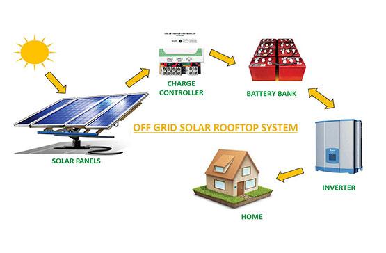
Off Grid Solar Market to Exhibit 12.3% CAGR and Generate $5,825.80 Million by 20 …
As per the report published by Research Dive, the global off grid solar market is predicted to generate a revenue of $5,825.80 million and grow at a stunning CAGR of 12.3% during the analysis timeframe from 2022 to 2031.
The global off grid solar market is predicted to witness prominent growth by 2031, owing to the increasing demand for electricity independence across the globe. The Asia-Pacific region garnered…

Roofing Materials Market to Garner a Revenue of $186.7 Billion and Exhibit a 4.3 …
As per the report published by Research Dive, the global roofing materials market is expected to register a revenue of $186.7 billion by 2031, at a CAGR of 4.3% during the forecast period 2022-2031.
The global roofing materials market is expected to grow primarily due to the growing need for waterproofing roofing materials. Re-roofing sub-segment is expected to flourish immensely. The Asia-Pacific region is predicted to grow at a high…
More Releases for Geospatial
Geospatial Solutions Market Opportunities and Trends | Key Profiles Till 2031 - …
The Global Geospatial Solutions Market size was worth US$ 492.76 billion in 2023 and is estimated to reach US$ 1132.93 billion by 2031, growing at a CAGR of 11.0% during the forecast period (2024-2031).
The Geospatial Solutions market report provides in-depth insights and analysis on key market trends, growth opportunities, and emerging challenges. With a commitment to delivering actionable intelligence, DataM Intelligence empowers businesses to make informed decisions and stay ahead…
Geospatial Analytics Market Report 2024 - Geospatial Analytics Market Trends, Gr …
"The Business Research Company recently released a comprehensive report on the Global Geospatial Analytics Market Size and Trends Analysis with Forecast 2024-2033. This latest market research report offers a wealth of valuable insights and data, including global market size, regional shares, and competitor market share. Additionally, it covers current trends, future opportunities, and essential data for success in the industry.
Ready to Dive into Something Exciting? Get Your Free Exclusive Sample…
Geospatial Solutions Market Anticipated to Experience Significant Expansion by 2 …
Geospatial Solutions Market is the focal point of DataM Intelligence's latest market research report, offering a comprehensive analysis of this dynamic sector. This in-depth study goes beyond a basic overview, exploring the intricate dynamics that shape the market. By examining regional trends, demand patterns, and potential breakthroughs, DataM Intelligence aims to empower businesses and stakeholders with valuable insights for navigating the evolving landscape. The insights from this report can illuminate…
Geospatial Solutions Market Booming Worldwide With Leading Key Players - Technol …
DataM Intelligence has published a new research report on "Geospatial Solutions Market Size 2024". The report explores comprehensive and insightful Information about various key factors like Regional Growth, Segmentation, CAGR, Business Revenue Status of Top Key Players and Drivers. The purpose of this report is to provide a telescopic view of the current market size by value and volume, opportunities, and development status.
Get a Free Sample Research PDF -…
Geospatial Analytics Market Bridging the Skills Gap: Unlocking Growth in the Geo …
Geospatial Analytics market to reach over USD 187.51 billion by the year 2031 Geospatial Analytics
InsightAce Analytic Pvt. Ltd. announces the release of a market assessment report on the "Global Geospatial Analytics Market Size, Share & Trends Analysis Report By Component, Solution (Geocoding and Reverse Geocoding and Thematic Mapping and Spatial Analytics), Type (surfacing & files analytics, network & location analytics and visualization), Technology (remote sensing, global positioning systems, and geographic…
